


 Francais
 Deutsch
 Italiano
Refine Your Search
US-Gliders- stock footage and images
- Showing 21355 to 21360 of 21920 results more
more Hide
Hide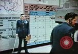
Observation stations located to provide information to pilots about weather conditions at airports
A United States Air Force Weather Service meteorologist points at a large synoptic chart and briefs about the weather, while being recorded and broadcast via television. USAF operators in a control tower as an airplane lands on a runway. To provide information to the pilots observation stations of the Air Weather Service are located at the end of the runways. A man enters an observation station. He works on equipment. Voice messages using pre recorded words translate machine weather data into understandable information for pilots.
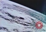
Hurricane Hunters. USAF and the National Hurricane Advisory Center working in cooperation in Miami, Florida.
Operations of the Hurricane Hunters in the United States. Extremely high altitude view looking down on a hurricane On the ground, trees blown up by winds and a town submerged in water. Meterologists and technicians working in the National Hurricane Advisory Center in Miami, Florida. Flight Operations building at Keesler Air Force Base, Mississippi. Air Force personnel reading weather messages. View from below of U.S. Air Force Military Airlift Command (MAC) Weather Service WC-130E/H aircraft taking off. A notice about the hurricane being printed out. The WC-130E/H aircraft in flight during a regular mission for checking wind speed and direction. A pilot and a co-pilot at the controls of the aircraft, which is encountering considerable turbulence. A dropsonde being ejected out from the aircraft. A man working on an instrument. A MAC Weather Service WC-130E/H aircraft taking off.
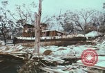
Characteristics and names by which tropical cyclones are known in different places is discussed in the United States.
A documentary in the United States on occurrence of tropical cyclones. A rubbled area after being hit by a tropical cyclone. Soldiers carrying a dead body on a stretcher. Cyclones are known by different names based on their geographical locations. Animation depicts names of cyclones in different areas with the help of a map. In the Western Pacific they are known as typhoons. They are known as Baguio in the Philippines. They are called cyclones in the Indian Ocean and the Bay of Bengal. In Australia they are called Willy-Willy. A cyclone is called a hurricane in the Eastern Pacific, the Gulf of Mexico and the Caribbean. Characteristics of tropical cyclones. Counter clockwise wind flow at the time of a cyclone. The pressure when the tropical cyclone approaches. The eye of the tropical cyclone may be very small or very large in diameter. The strongest winds around an eye average from 90-150 knots. The storm is divided into semicircles for orientation. The right semicircle is considered to be the most dangerous semicircle because of its stronger wind. The left is considered to be relatively less dangerous because of somewhat weaker winds. A demonstration is done by considering ships stuck in both the parts. The ship stuck in the right semicircle revolving in the area. The ship stuck in the left one arrives towards the end and comes out of the storm. Ships underway at sea during a storm. Clouds in the sky. Rain begins to fall. A man checking a parametric center. Animation shows a ship arriving towards the storm center. The ship's radar used to locate the ship's location.

Safety measures and precautions which can be taken in the event of a tornado, in the United States.
A documentary on occurrence of a tornado in the United States. The aftermath of a tornado in Wichita Falls, Texas. A rubbled area. A man standing near the rubble. Dead bodies on the ground. Doctors treating wounded people. Red Cross workers and volunteers working to help the victims. Temporary housing facilities given to homeless people. Rebuilding work being undertaken. People standing outside a house. A doll on the ground. Disaster plans being worked upon. People discussing amongst themselves. Narrator outlines preventive measures, warnings, and emergency plans and Disaster Plans that should be in place to in the event of a tornado. Narrator discusses what to do, and what not to do in the event of a tornado. National Oceanic and Atmospheric Administration (NOAA) weather radio should be used. It gives warning about tornadoes. When a tornado hits people should take cover in basements. Weather clues should be noticed, warnings should not be ignored and people should not stay in mobile houses at the time of tornadoes. People can take shelter in a ditch. Matches should not be lit and people should not enter the disaster area. Views of the April 10, 1979 tornado in Wichita Falls, Texas as it hits the area.
Rescue missions provide food and medical supplies and flood relief in Texas after Hurricane Beulah
Flooding in aftermath of Hurricane Beulah in South Texas, United States. An area submerged in water. View of the Nueces River completely over its banks and flooding a massive area. Aerial view of flooded land under water. Officers discussing about the flooding. An officer talking over a phone. Aerial view of flood waters having broken through a dam and sending flood waters into Harlingen through the Arroyo Colorado. People laying sand bags to control flooding. Rescue work being carried on. People traveling in a motor boat to stranded residents in Harlingen Texas. U.S. Army helicopters hovering over the area to evacuate the Texas State Tuberculosis Hospital. The hospital patients being treated by doctors and nurses. Aerial view of the flooded area in Texas and in Mexico. Food and medical assistance being provided to the people by helicopter airlift. People lined up outside a building. The doctors and the nurses treating the wounded.
Scenes of Miami Florida in the late 1940s; animation shows conditions which result in the formation of a hurricane in Miami, Florida.
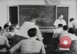
A documentary on Weather Bureau's Hurricane Warning Center in Miami, Florida. (Later the National Hurricane Center, part of the U.S. NOAA / National Weather Service). A man instructing students about a hurricane. They discuss about the conditions present when hurricanes develop. Animation shows the process of formation of hurricanes. Large masses of air become warm and moist. It is replaced by air flowing from all directions. Aerial view of a sea. The air starts moving in a circular motion. The progressive motion of the air begins and it becomes a hurricane. Men and women working in the Hurricane Warning Center analyze these conditions. View of traffic and commercial buildings along a busy street in Miami. Three men playing golf. Elevated view of people seated in a stadium watching a horse race. Elevated view of a crowded ocean beach in Miami. Aerial view of a weather station on the eastern tip of Cuba. Men preparing to release a radiosonde weather balloon. They analyze the weather conditions for a daily weather report.
CRITICALPAST.COM: About Us | Contact Us | FAQs - How to Order | License Agreement | My Account | My Lightboxes | Shopping Cart | Advanced Search | Featured Collections | Website Terms & Conditions | Privacy Policy ©2026 CriticalPast LLC.
License Agreement |
Terms & Conditions |
Privacy Policy
©2026 CriticalPast LLC.