


 Francais
 Deutsch
 Italiano
Refine Your Search
US-Gliders- stock footage and images
- Showing 5755 to 5760 of 21998 results more
more Hide
Hide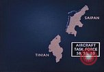
Animated map shows U.S. Aircraft Task Force bombarding Tinian and Saipan Island in the Mariana Islands.
Animated map shows Saipan, Marian Islands. Animation shows U.S. forces acquiring the island from the Japanese during World War II. Aircraft Task Force 58, 52 and 53 approach Tinian and Saipan islands. Aircraft destroy anti aircraft guns, sugarcane fields, coastal areas, buildings and communication centers on the islands.
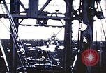
Animation shows U.S. aircraft bombing Saipan, Mariana Islands during World War II.
Animated map shows Saipan in the Marian Islands. Animation shows U.S. forces acquiring the island from the Japanese during World War II. Pictures of American ships approaching the island. Marines aboard a ship look at maps. Animation shows United States aircraft bombing Saipan island.
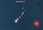
Animation shows U.S. forces bombing Pagan Island in the Mariana Islands during World War II.
Animated map shows U.S. forces acquiring Pagan Island, Mariana Islands from the Japanese during World War II. Pictures of bombings on Pagan Island. Fire and explosions on a ship. American ships fire at the Japanese Army on a beachhead. A fleet of aircraft drop bombs on the island.
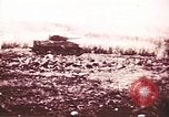
Pictures show U.S. 2nd and 4th Infantry Divisions' advance and wreckage of Japanese equipment on Saipan, Mariana Islands.
U.S. forces battle against the enemy on Saipan, Mariana Islands during World War II.. Soldiers advance with tanks. Landing crafts head towards a beachhead. The 2nd and 4th Infantry Division advance in formation. A damaged Japanese air field with a wrecked hangar.
The "El Aquario" support ship for the U.S. Army Air Corps Alaska Flight Project, transiting Seymour Narrows, at Vancouver Island
Views from deck of the "El Aquario," supply ship supporting the U.S. Army Air Corps Alaska flight project in 1934. The ship is passing through the Seymour Narrows, on Eastern edge of Vancouver Island, Canada. A steamship is seen approaching from the South, astern. It is a three funnel passenger ship that passes to port of the El Aquario. View from pilot house of waters at North end of the narrows. Dolphins swimming along with the ship are seen from the bow. Seagulls land on the deck and superstructure of the ship. Strong tidal currents are seen flooding in from the North.
U.S. Army Air Corps 1934 Alaskan flight progressing through Prince George, British Columbia, and White Horse Yukon, Canada
YB-10 aircraft, of the U.S. Army Air Corps 1934 Alaskan flight, are parked on a flower-covered meadow in Prince George, British Columbia, Canada. An animated map shows onward flight from Prince George, to White Horse, Yukon, Canada. A formation of YB-10s in flight, and then, parked on a grassy field in White Horse. Lieutenant Colonel Henry H. "Hap" Arnold, leader of the expedition, and some of his fliers stand, conversing. In the background, others are busy refueling their aircraft. One flier is seen rolling a 55 gallon drum of gasoline. Animated map depicts futher progress to Fairbanks, Alaska. Views of rivers and mountains, and ground below with patches of snow, as seen from one of the aircraft in flight.
CRITICALPAST.COM: About Us | Contact Us | FAQs - How to Order | License Agreement | My Account | My Lightboxes | Shopping Cart | Advanced Search | Featured Collections | Website Terms & Conditions | Privacy Policy ©2026 CriticalPast LLC.
License Agreement |
Terms & Conditions |
Privacy Policy
©2026 CriticalPast LLC.