


 Francais
 Deutsch
 Italiano
Refine Your Search
Vietnam Bien Hoa Air Base 1965 stock footage and images
- Showing 3355 to 3360 of 13233 results more
more Hide
Hide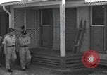
Flyers of a USAF 59th Weather Reconnaissance Flight crew plan a mission
Flight crew of the U.S. Air Force 59th Weather Reconnaissance Flight (Hurricane Hunters) at Kindley Air Force Base, walk to their operations office. A Captain and a Lieutenant prepare a flight plan. The Lieutenant uses a Weems plotter on a map, while the Captain uses a large E6B computer to calculate course headings,taking wind into account. The Lieutenant writes the headings on their flight plan. When finished,they place the map and flight plan into a briefcase.
A WB-50D aircraft of the 59th Weather Reconnaissance Flight takes off from Kindley AFB, Bermuda
A U.S. Air force WB-50D Weather Service aircraft, tail number 50-4040, assigned to the 59th Weather Reconnaissance Flight (Hurricane Hunters) begins a takeoff roll and goes a long distance on the runway, but is never seen actually breaking ground. Navigator steps up into bubble canopy with a sextant. View from behind the copilot in cockpit of a WB-50D, as it takes off from Kindley Air Force Base, Bermuda. View of pilot in the left seat, at the controls. View of the copilot. in the right seat.
Aircraft Commander checks parachutes of crew prior to takeoff of a WB-50D Hurricane Hunter aircraft
Crew of a U.S. Air Force WB-50D Hurricane Hunter aircraft stand by their aircraft (Tail number 50-4040) on the ramp at Kindley Air Force Base, Bermuda. They are all wearing back-pack parachutes. The Aircraft Commander checks each crew members chute. Closeup of the Aircraft Commander (Captain). The aircraft and crew are of the 59th Weather Reconnaissance Flight.
Crew members at duty stations in WB-29D aircraft of the USAF 59th Weather Reconnaissance Flight at Kindley AFB, Bermuda.
Crew member speaking on interphone in a U.S. Air Force WB-29 Hurricane Hunter aircraft. View of the pilot advancing the throttles and pulling back the yoke (staged). Scene repeated. View of flight engineer advancing throttles at his panel location. Dropsonde operator entering data on a form. Ground crewman disconnects auxiliary power unit from parked WB-29 aircraft parked at Kindley Air Force Base, Bermuda. View from nose gear well, of number three engine running on a WB-29 aircraft.

U.S. 4th Marines and 7th Infantry Division land on the Marshall Islands and Japanese ships are strafed in the Pacific Ocean.
A film titled: 'Attack on the Marshalls' depicts landing of U.S. troops on the Marshall Islands during World War II. A Japanese flag flying atop a flag pole. Animated map shows areas occupied by the Japanese. U.S. troops invade the areas. Marshall Islands, New Guinea and other places on the map. The 4th Marines and the 7th Infantry Division land on the Marshall Islands. U.S. airplanes taking off from an air base. They fly in formation overhead. A Japanese ship convoy underway in the Pacific Ocean. They are strafed from the air. Smoke arises as the ships explode. Aerial view of the Pacific Ocean. U.S. airplanes aboard an aircraft carrier underway. Japanese airplanes being shot down by United States aircraft and crashing into water, as seen in wing camera or gun camera footage .
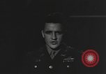
USAAF Major General Paul L. Williams and soldiers of 9th Troop Carrier Command standing near airplanes in Europe
An officer seated at a desk and speaking about the Battle of the Bulge action near Bastogne, Belgium with U.S. troops during World War II. He recognizes the forces of the 9th Troop Carrier Command (operating out of England, United Kingdom and out of France) for reaching them with important supply drops late in the battle. United States Army Air Force ( USAAF ) Major General Paul L Williams inside a glider cockpit (while parked) and officers and crew standing and walking together on airfield areas. Airplanes parked at an air base. Pilots and crew standing nearby. Close up views of faces of many of the U.S. Army personnel of the 9th Troop Carrier Command, including pilots, ground crew, officers. Point of view shot from inside a glider aircraft cockpit as pilots negotiate landing in a field. Smiling officers, soldiers, and crew of the 9th Troop Carrier Command.
CRITICALPAST.COM: About Us | Contact Us | FAQs - How to Order | License Agreement | My Account | My Lightboxes | Shopping Cart | Advanced Search | Featured Collections | Website Terms & Conditions | Privacy Policy ©2026 CriticalPast LLC.
License Agreement |
Terms & Conditions |
Privacy Policy
©2026 CriticalPast LLC.