


 Francais
 Deutsch
 Italiano
Refine Your Search
Vietnam Bien Hoa Air Base 1968 stock footage and images
- Showing 11893 to 11898 of 13286 results more
more Hide
Hide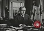
American Undersecretary of War speaks to difficulties facing Allies in confronting Germany and Japan in World War II
Undersecretary of War, Robert Porter Patterson, Sr. speaks about a report from the General staff outlining the needs for combating Germany and Japan in World War 2. He cites Operation Husky, the invasion of Sicily, as an example of what will be needed. He continues to narrate in the background as an animated map appears showing the buildup of supplies and Allied forces in North Africa; Allied air forces flying 60 thousand sorties over Sicily and, the direct amphibious assault using 3,200 vessels. Map also depicts opposing forces of 12 (“unwilling”) Italian Divisions and 3-1/2 German Divisions. View of Allied troops carrying some of their 31 thousand casualties on stretchers from field ambulances. Allied medics attending to the wounded. Some are seen lying on stretchers in a row on the ground near a wall. Interior of a field hospital where surgeons and other medical personnel treat the wounded. Animated map shifts to Europe with Germany at its center, showing , in contrast to Sicily that was only an “outpost,”, the heavily fortified perimeter of Axis controlled areas; the axis industrial might; and the disposition of 300 German Divisions (mostly on the Eastern front) defending the region. Next, the map illustrates Japan’s defended regions in the Pacific Image returns to Undersecretary Patterson i n his office, speaking of the Allied offensives planned for next year (1944), and emphasizing their challenge and difficulty. Scene shifts to General Jonathan Wainwright and his garrison at Corregidor, in the Philippines, surrendering to Japanese forces in 1941. Japanese military camera pans over the Americans being taken prisoner. Other Americans and Filipinos are seen being marched together under guard. Scene shifts to classic views of the Japanese attack on Pearl Harbor, Hawaii, on December 7, 1941. View of Japanese soldiers executing two Chinese civilians in 1937. Dangling bodies of persons hung by Nazis during Operation Barbarossa in Russia, in 1941 A Russian soldier comforts a little girl as he escorts her across a snowy landscape. Time bomb left by German forces retreating from Naples, Italy, in 1943, blows up a Post office building . Views of damage to building and bodies of victims. American Military Police assisting a victim. American soldiers carrying an injured civilian on a litter. Scene shifts to British Foreign Minister, Anthony Eden, Soviet Foreign Minister, Vyacheslav Molotov, and U.S. Secretary of State, Cordell Hull, entering a hall in the Spiridonovka Palace, during the 1943 Moscow Conference in Russia. Close-up of the American, Soviet, and British flags on a table. View of many delegates seated around the table. Close-up of Molotov, Eden, and Hull signing conference document.
Amphibious Task Force 9 soldiers carry supply boxes in Aleutian Island, Alaska
Amphibious Task Force 9 soldiers carry supply boxes in Aleutian Island, Alaska. Wrecked Japanese air planes and huts on the island. (World War II period).
U.S. forces launch attacks against Japanese targets from the Aleutian Islands during World War II
Film opens showing animated map of Pacific and avenue of attack against Japan via the Aleutian Islands in World War 2. . Scene shifts to the Aleutian Islands, where American P-47 aircraft are seen parked on an open ramp in severe winter weather. Next, American Army truck convoys are seen traversing subarctic Canada on the Alcan highway, with supplies to sustain U.S. forces in the Aleutians. U.S. soldiers and airmen are seen obtaining various items and playing volleyball on a ramp at an airbase. Fog shrouds the Aleutians keeping aircraft grounded. Soldiers look at maps and plan targets. Aircrews are briefed about their mission and targets. U.S. Army Air Forces B-24 Liberator bombers fly in formation over snow-covered peaks. View looking down on a B-24 headed toward Japan. Airmen in a headquarters plotting the disposition of aircraft reporting to them by radio. View above thick clouds with nothing in sight. (But exploding bombs are heard.) (World War II; WW II; World War 2; World War Two)
Allied planning for the final invasion of Japan in World War II
Scene opens with a map illustrating one possible Allied path for invasion of Japan. It proceeds from India and Burma to China and thence to Japan. A U.S. B-24 bomber is seen landing at a Far East Air field. Next, the Supreme Allied Commander of South-East Command (SEAC) Admiral Lord Mountbatten, is seen posing with Chinese General Li Zongren (AKA Li Tsung-jen) and other high ranking Chinese officers, and then walking with them. Next are views of U.S. General Joseph Stillwell working with staff as they consult maps. Then, Chinese laborers are seen engaged in construction of a bridge over a riverbed, that is to be part of the "Ledo Road,"traversing Burma and providing a highway from India to Chunking, China. Trucks moving over the already completed segments of the road, carry men and war materiel. One truck passes a local native drawing water from a well using a long counterbalanced pole. At the frontier of the roadbuilding, Chinese soldiers chop their way through dense jungles and battle Japanese forces firing at them. A fallen soldier. Allied soldiers shouting as run into a village engaging Japanese forces. Structures in the village burning and spreading in the area. Scene shifts abruptly to an animated map illustrating what are believed to be the Japanese plan for its last desparate defense. It shows them falling back to highly defensible boundaries encompassing sources of supplies needed to sustain their defense. Aerial views of Manchurian landscape. Japanese officials are seen at their administrative offices in Manchuria. Large numbers of Manchurian workers are seen headed to work near a factory. Others are engaged in open pit mining, where explosives are used to expose and ready ores for extraction. Views inside a Manchurian steel plant supporting the Japanese war effort. Japanese military forces are shown moving by horseback in the area, ostensibly to push further into China and add more protection against potential Allied offensives. Likewise, Japanese warships are shown at sea maneuvering to defensive locations. This is all summed up in a map showing the expected disposition and status of military defensives for Japan's final defense (Fortress Japan). Street traffic on a city street in Japan. A large group of Japanese women in traditional dress, carry banners and quietly bow. View of the Japanese Diet Building (Parliament) and political and Military leaders inside, including Prime Minister Tojo, Hideki.
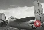
United States B-25 bomber and crew at Alexai point Landing Field, Attu Island, Alaska
Shown is tail section of a U.S. B-25 medium bomber, tail number 43-36154, assigned to the 11th Air Force, 77th Bombardment Squadron (Medium). Twin tails and tail gunner position and guns visible. Snowy slopes seen in background. In the first scene that shows members of the flight crew standing in front of number two engine, they are believed to be: starting back left (moving to the right behind the propeller): Armorer/Tail gunner: Samuel Ward Craig (Shelocta, PA), Pilot: Willard L. Castledine (Three Rivers, MA), Radioman/Waist Gunner: Hugh W. Wilson (Paducah, KY), (coming around to the front of the propeller on the right moving left), Navigator/Bombardier: Kemmer W. Schricker (Davenport, IA), Co-Pilot: Kenneth H. Wait (Rickreal, OR), Engineer/Turret Gunner: Roman F. Ales (Luling, TX) The crew members pull engine #2 through, with the propeller, to assure against hydraulic lock, before starting. (World War II period).
Effect of high and low pressure on weather conditions
Concepts of high and low pressure and moving air masses and their effects on weather conditions. Direction of wind flow in high and low pressure areas. A map shows high and low pressure areas in America during different times in year.
CRITICALPAST.COM: About Us | Contact Us | FAQs - How to Order | License Agreement | My Account | My Lightboxes | Shopping Cart | Advanced Search | Featured Collections | Website Terms & Conditions | Privacy Policy ©2026 CriticalPast LLC.
License Agreement |
Terms & Conditions |
Privacy Policy
©2026 CriticalPast LLC.