


 Francais
 Deutsch
 Italiano
Refine Your Search
Vietnam Bien Hoa Air Base 1968 stock footage and images
- Showing 3439 to 3444 of 13285 results more
more Hide
Hide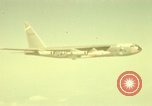
NB-52B Stratofortress with rocket powered aircraft X-15A in flight as the X-15A detaches in California.
Test flight of rocket powered aircraft X-15A at Edwards Air Force Base in California. NB-52B Stratofortress with Rocket Powered Aircraft X-15A in flight. Insignia of United States. It leaves a smoky trail. X-15A detaches from NB-52B and in flight. It leaves a smoky trail and flies into a distance.
X-15 lands after first high powered flight.
X-15 lands after first high powered flight using XLR-99 engine. Chase plane accompanies X-15 as it maneuvers to land at Edwards Air Force Base, California. Parachute seen as lower ventral fin is jettisoned prior to landing. X-15 comes to stop on runway after long ground roll on landing.
First powered flight of an X-15 Rocket Plane. Also scenes of several other X-15 powered flights.
X-15 first powered flight on Thursday, 17 September, 1959. (X-15 No. 2, tail number: 56-6671 with LR-11 engines. Scott Crossfield flew this mission at mach 2.11 and altitude 52,341 feet.) Scenes of several other X-15 powered flights are also shown. View of the water tower at Edwards Air Force Base, california. Overhead, NASA NB-52A, No. 003 and an F-100D chase plane, are seen at high altitude, with contrails behind them. The X-15, cradled under the B-52's right wing, drops clear, starts its rocket engines and begins its first independent powered flight, climbing rapidly away from the B-52. NASA camera tracks it, appearing as a moving white dot against the sky. The next sequences show later powered flights. View of NASA B-52 and three chase planes leaving contrails overhead. X-15 drops, its engines are running and falls behind the B-52, before accelerating rapidly, passing to its right, and continuing upward. Another scene shows brief glimpse of NASA B-52 overhead (no contrails). In final scene, X-15 is seen moving rapidly, leaving a long contrail behind it. Cloud then obscures the image somewhat.
NASA B-52 taxis out for takeoff, carrying an X-15 rocket plane under its right wing
NASA NB-52A aircraft, tail number 52-003, parked at Edwards Air Force Base, with an X-15 rocket plane cradled under its right wing. Two men run across the ramp to the aircraft. One carries a ladder. The B-52 taxis out. View through windshield of a vehicle following the B-52 as it taxis.
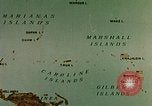
U.S. Naval Task Force 58, including USS Yorktown attacked by a Japanese Kawanishi H8K flying boat in the Pacific.
USS Yorktown CV-10 in the Pacific Theater during World War II. Early 1944: Animated map shows the Caroline Islands, Mariana Islands, Gilbert Islands and the Marshall Islands in the Pacific. The U.S. Naval fleet advances from Truk Islands towards an advanced naval base in the Marshall Islands, taken from the Japanese. U.S. ships underway around the fleet anchorage. U.S. Navy Aircraft Carriers, battleships, cruisers, fleet auxiliaries and support ships. Crew and aircraft on the flight deck of the 'Fighting Lady' CV-10. The crew members relax and enjoy themselves in the water. They dive and jump off a makeshift platforms and diving boards into the ocean, and then swim and play around large floating rafts. Sailors sort letters in the ship's post office. Some write letters back home. The crew assembled on the ship deck. Commander of the ship Rear Admiral Joseph James 'Jacko' Clark briefs the crew about their mission, designation to Task Force 58, and advance towards Tokyo. The USS Yorktown and other carriers of the Task Force underway. Sign boards for various Ready Rooms on the ship. Air Group Commanders and pilots ready on call. Rear seat gunners and radio men on call in another Ready Room nearby. They talk, relax, drink Coca-Cola and have ice cream. Flags on board. Commander of the TF 58 Admiral Marc Andrew 'Pete' Mitscher and Skipper Clark on the flight deck. A poster for the ship board movie 'Home in Indiana'. Sailors watch the movie. Planes in flight through clouds, the Task Force underway seeking the Imperial Japanese Naval fleet. New cruisers, Coast Guard cutters and Navy Transports in the Task Force. The patrol spots a Imperial Japanese Navy search plane, a Kawanishi H8K flying boat called 'Emily' by the Allies. The plane fires at the Task Force ships before being hit and sinking in the water. U.S. officers and sailors in a discussion. An animated map depicts the objective to move towards and free the Mariana Islands.
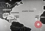
Early Warning Squadron Four take off to detect the occurrence of hurricane in the United States.
The role of Airborne Early Warning Squadron Four in the United States. Animated map depicts the regions susceptible to hurricanes including the Gulf of Mexico, Caribbean region. Hurricane Hunter aircraft in flight over an air base. Crew members gather near the aircraft. Crew members being briefed about the mission. Crew members in the cockpit of the aircraft. Weather team records meteorological data aboard an airborne aircraft. Radar team at work as they detect the chances of occurrence of a hurricane. A crew member prepares food aboard the aircraft. Crew members relax and read. A radar screen depicts the occurrence of a hurricane. Weather team checks the sighting. A barometer reading. Meteorological experts work on weather maps.
CRITICALPAST.COM: About Us | Contact Us | FAQs - How to Order | License Agreement | My Account | My Lightboxes | Shopping Cart | Advanced Search | Featured Collections | Website Terms & Conditions | Privacy Policy ©2026 CriticalPast LLC.
License Agreement |
Terms & Conditions |
Privacy Policy
©2026 CriticalPast LLC.