


 Francais
 Deutsch
 Italiano
Refine Your Search
Walcheren Island Netherlands 1944 stock footage and images
- Showing 1075 to 1080 of 9701 results more
more Hide
Hide
Animated map shows the location of Saipan and the geographical details of the Mariana Islands.
The film 'The Marianas Operation Phase I, Saipan' shows the location of the Mariana Islands through an animated map. Animation shows geographical details of Saipan. It shows its dry and wet seasons. Fringing and barrier reef on the Western Coast. A harbor at a wharf. The map shows the location of a boat yard.
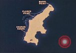
Animated map shows various air strips Marpi Point, Flores Point and Charan-Kanoa on Saipan, Mariana Islands.
Animated map gives geographical details of Saipan, Marian Islands during World War II. Animation shows air strips named Marpi Point, Flores Point and Charan-Kanoa. An aerial view pictures of Japanese held area on Saipan.
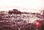
Pictures show U.S. 2nd and 4th Infantry Divisions' advance and wreckage of Japanese equipment on Saipan, Mariana Islands.
U.S. forces battle against the enemy on Saipan, Mariana Islands during World War II.. Soldiers advance with tanks. Landing crafts head towards a beachhead. The 2nd and 4th Infantry Division advance in formation. A damaged Japanese air field with a wrecked hangar.
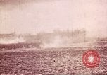
United States troops fire at Japanese cave entrances and advance on Saipan, Mariana Islands.
U.S. forces battle against the enemy on Saipan, Mariana Islands during World War II.. Troops fire at Japanese cave entrances. Animated map of Saipan shows territories occupied by U.S. forces. Officers look through telescopes. Soldiers load and fire artillery at the enemy. The troops advance with tanks.
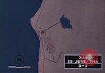
United States troops load and fire artillery at Japanese positions on Saipan, Mariana Islands.
U.S. forces battle against the enemy on Saipan, Mariana Islands during World War II.. Animated map shows United States troops arriving on Green Beach. The troops fire at Japanese cave entrances. They advance with tanks. A captured Japanese anti aircraft gun. Soldiers open crates of captured mortar ammunition. Fire and explosions. The soldiers load and fire artillery.
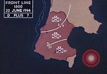
U.S. 2nd Infantry Division tanks advance and a P-47 Thunderbolt aircraft taxis on a runway in Saipan, Mariana Islands.
U.S. forces battle against the enemy on Saipan, Mariana Islands during World War II.. Animated map shows southern territory occupied by U.S. forces. Officers converse with each other. 2nd Infantry Division tanks advance. A United States Army Air Force P-47 Thunderbolt aircraft taxis on a runway.
CRITICALPAST.COM: About Us | Contact Us | FAQs - How to Order | License Agreement | My Account | My Lightboxes | Shopping Cart | Advanced Search | Featured Collections | Website Terms & Conditions | Privacy Policy ©2026 CriticalPast LLC.
License Agreement |
Terms & Conditions |
Privacy Policy
©2026 CriticalPast LLC.