


 Francais
 Deutsch
 Italiano

Refine Your Search
Italy airfields stock footage and images
- Showing 2257 to 2262 of 3791 results more
 Hide
Color Sound

A mill where tanks, armored cars and tractors are built in Italy.
An Italian mill where tanks, armored cars and tractors are built. Scenes of men doing work on tractors and armored cars at the mill. Men holding a vehicle tire. A man holding tracks of a tank. Body of the tanks. L6-40 Semovente light tanks ready in a yard.

Flood causes heavy destruction in Northern Italy.
View of destructions caused on Vajont Dam due to a landslide which fell from top of the mountains. View of River Piave. Animated map which explains how a landslide fell into reservoir and caused heavy destruction which wiped out villages and hamlets. Rock falls and ruins of villages shown. Italian troops with people in rescue operations. Troops carrying wounded and dead on stretchers. Women crying. United States Army helicopter lands. Troops searching for people still alive at disaster site. In the village of Longarone, 80% of the inhabitants are dead.

Fascist Wreath laying Procession at memorial to fallen soldiers in Italy. Huge wreath carried by many persons.
Fascists, carrying flags with their emblem, march in wreath laying procession at memorial to fallen Italian soldiers shortly after the end of World War 1. They throw small garlands on inlaid plaque as they pass and , with many men carrying it, they place a giant wreath, with large "V" on it, at foot of monument to fallen soldiers.
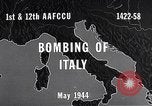
U.S. Army Air Forces A-36 fighter bombers attacking lines of communication in Italy during World War II
Animated map shows areas of targeting, in Rome environs, by U.S. warplanes during Italian campaign in World War 2. Gun camera footage from a U.S. Army Air Forces A-36 aircraft captures strafing from altitude of feet, of loaded Italian transport vehicles on Italian highway 6, connecting Rome and Cassino. Another map highlights a bridge at Civita Castellana. Gun camera shows it being strafed from only 300 ft. altitude, and attacked with 500 pound bombs. Similar attack is highlighted at a road near Frosinone, Southeast of Rome, where A-36 fighter bombers strafe motor transports and bomb the road. Similar footage is shown for targets being attacked at: Monte Si Savino; Sezze; Terracina; Castro de Volsci. Views from one A-36 camera when pilot flies low in a valley looking for targets of opportunity. He strafes vehicles on a road and pulls up sharply to avoid a mountain and then continues attack on the other side.

United States Army 36th Infantry troops advance firing at enemy in Italy during Battle of the San Pietro.
Map shows San Pietro, Mount Lungo, Mount Sammucro. Explosions in the valley. 36th Infantry Division troops carry dead soldier on litter. Officer speaks over phone. Troops advance uphill. Soldiers move forward taking cover behind trees. Dead soldiers on ground. Explosion on ground. Dead bodies of soldiers placed on litter. (World War II period).

36th Infantry troops advance firing at German enemy in Italy during Battle of San Pietro.
Map shows San Pietro, M. Lungo, M. Sammucro. 36th Infantry Division troops fire machine gun. U.S. Army soldiers advance uphill. Large explosions. Dead soldiers on ground. P-38 Lighting escorts fly in formation. German plane falls. General Clark examines a map. Officer speaks over phone. Troops fire 155 mm Howitzer and tanks at German enemy. Soldiers check time on their watches. (World War II period).
CRITICALPAST.COM: About Us | Contact Us | FAQs - How to Order | License Agreement | My Account | My Lightboxes | Shopping Cart | Advanced Search | Featured Collections | Website Terms & Conditions | Privacy Policy ©2026 CriticalPast LLC.
License Agreement |
Terms & Conditions |
Privacy Policy
©2026 CriticalPast LLC.