


 Francais
 Deutsch
 Italiano
Refine Your Search
+"China" +1937 stock footage and images
- Showing 19 to 24 of 56 results more
more Hide
Hide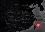
Bombing of Chungking (Chongqing), China, by Japan, in Second Sino-Japanese war
The Republic of China establishes its wartime capital at Chungking (Chongqing), China during the Second Sino-Japanese War. Animated map depicts areas of Japanese occupation and highlights cities including Lanchow (Lanzhou), Chengtu (Chengdu), and Kunming. It highlights Chungking (Chongqing) as the Nationalist Republic of China. Chiang Kai-Shek is seen leading a group of Chinese leaders as they walk through an arched gate in Chungking (Chongqing). A busy street with shops and apartment houses in a commercial district. Busy scene of pedestrians, cart traffic, and automobiles in the road center. Boats on the Yangtze River are seen below long steep steps leading up to the streets above. Houses along the cliffs. Chinese workers digging bomb shelters into the cliffs. View from inside a shelter being hollowed out of the rock. Back in the Japanese occupied area, a car brings a Japanese Air Force leader who addresses a large group of fliers at an airbase. Next, Japanese aviator crews are seen running to their aircraft from their camp on the airfield. They take off in Mitsubishi G3M bombers to attack Chungking (Chongqing). Nakajima Ki-27 airplanes take off from the field and join in large formations overhead. A formation of Chinese World War 1 era aircraft is seen in flight to engage incoming Japanese bombers. Japanese crew member in a bomber sees the Chinese fighters and gunners in the bombers get ready to fire on them. The Chinese fighter planes dive at the bombers but are intercepted by Nakajima Ki-27 airplanes flying cover. Dogfights ensue with Chinese aircraft being shot down, and the bombers continuing their way. Air raid sirens sound in Chungking (Chongqing) and people run to their shelters, including school children. Views of bomber crews at their stations and then of bombs falling with the Yangtze River below. Bombs exploding along the riverfront and inland, along the cliffs. View of machinery operating, and Chinese workers occupied in underground factories in Chungking (Chongqing). Fires burning throughout the city from the bombing, and Chinese fire fighters with hoses working to extinguish fires.

Various scenes depicting animated maps of China, seaplane landing in San Francisco, and streets in Beijing
Flag of the Republic of China (ROC) flying. Map shows travel routes between West Coast USA and Shanghai or British colony of Hong Kong. A seaplane or flying boat takes off. Seaplane flying over Golden Gate Bridge. Chinese American women wave at plane. Aerial view of a palace, pagoda, and surrounding grounds in China. Animated map comparing the sizes of United States and China. Yankee clippers underway at sea. Map shows position of Canton (Guangzhou). View of Canton harbor from a ferry. View of ferry's rail. Map of Beijing, also known as Peking or Peiping. Streets and buildings in Beijing.
Southwest and West side of China.
Southwest and West China. Map of China. Riverside village shows truck crossing on ferry. Mountains in area. Intricate bridge crossing river.

Japanese attack the United States ship Pannay and people on board rescued in China.
Japanese attack on the United States Ship Pannay in China. An interpreter at a desk explains how the pictures of bombing and sinking of United States ship Pannay were obtained. Destructed buildings in Nanking, China after a Japanese attack. Debris spread all over. A dead body in a field and a woman by its side. American embassy evacuated. American envoys embark onto United States ship Pannay. Japanese aircraft attack the ship and drop bombs. Damaged interior of the ship. Anti aircraft guns aboard the ship fired. Men injured by bombing transferred to a boat along side the ship. Boat pulls away from the coast. Men at the bank of a river. Injured brought to the bank. Smoke rises from the coast after standard oil beat catches fire due to Japanese bombings. Wounded taken care of after landing ashore.
Japanese invade China during the Sino-Japanese War
A Japanese warship sails on rough sea. The Japanese Rising Sun Flag waving. Barrel of a ship artillery. Chinese characters displayed at the Headquarters of Japanese Naval Landing Party in Shanghai, China. Imperial Japanese Army (IJA) Type 87 Crossley armored cars driving out of a garage. Vickers Crossley armored cars driving in China. Japanese infantry marching on a field and crossing a river on foot. Tanks crossing a river. Japanese troops move horses and supplies on a pontoon bridge and road. Calvary passing through corn field. Soldiers view a mountain. Japanese troops with camouflage helmets running. Japanese gunners firing artillery from fields. Infantry charging. A soldier charging with a bugle.
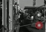
USS Gunboat Panay destroyed by Japanese bombing in the Yangtze River, China.
Japanese bombing of USS Gunboat Panay while she was anchored in the Yangtze River in China. Injured sailors helped into life boats. View of the damage to the ship's deck.