


 Francais
 Deutsch
 Italiano
Refine Your Search
+"Philippines" +1941 stock footage and images
- Showing 31 to 36 of 37 results more
more Hide
Hide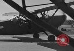
Stinson L-5 planes flies low over shoreline and woods, Palawan in Philippines.
Stinson L-5 planes parked on sea shore at Palawan in Philippines. L-5 in flight over water. Mountains and clouds in the background while L-5 passes over water. Close views of pilots flying L-5 plane. L-5 in flight as seen from another L-5 in flight. L-5 in flight over shoreline and woods.
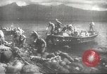
Japanese troops arrive at a shore and advance through jungles into Manila, Philippines.
Invasion of Manila, Philippines by Japanese troops during World War II. Japanese troops arrive at a shore. They fire rifles and machine guns. Smoke in the foreground. Damaged buildings and a church. Japanese tanks and infantry advances through jungles into Manila.
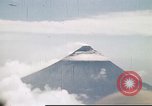
Smoke issuing from the Mayon Volcano on Luzon island in the Philippines.
Mayon Volcano on Luzon island in the Philippines. An aerial view shows puffs of smoke rising from the volcano. View of the volcano from the ground. A U.S. Army airman looks at the volcano.
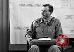
Major Tisdell speaks about time of American surrender during the trial of General Homma in Manila, Phillipines.
U.S. Army Major Achille C. Tisdell testifies before a military tribunal in Manila, Phillipines during the trial of Japanese Army General Masaharu Homma for World War II crimes. Major Tisdell, aide-de-camp to Commanding General of the American forces in Luzon Major General Edward King, is asked about a base hospital. He says that injured American soldiers were taken care of. He also says that enough ration was available for American troops in Bataan. He testifies that Major General Edward King was taken from Camp O'Donell to a camp at Tarlac. A member of the tribunal asks about the time when the order of the surrender was issued. Tisdell replies that he does not remember the exact time. He also talks about December 1941 when he worked in an artillery section in Manila. A woman at a typewriter as Major Tisdell testifies.
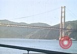
U.S. Army troops bound for the Philippines aboard the SS Etolin, prior to World War II, in the Pacific.
U.S. Army troops departing San Francisco, California for the Philippines, aboard the USAT Etolin, before World War II, in the Pacific. The Golden Gate Bridge and the San Francisco Bay as seen from the ship passing under the bridge. Passengers seen in life jackets during mandatory first emergency ship drill. Ship flags and a smoke stack. A man reads a book while relaxing on a sun lounger. Views from ship as it arrives in port of Honolulu. View of the Aloha Clock Tower on Pier 9 at Honolulu Harbor. Lifeboat suspended from davits. Soldiers sunbathing on the deck. Army officers conversing with the ship's Captain.
Pre-war views of cities and countries in Pacific region; wartime views of Japan attacking nearby nations
Animated map of Pacific region shows sphere of Japanese influence and potential areas for Japan to control in the Southwest Pacific during World War 2. Majority of scenes are from before outbreak of World War 2. Final scenes of clip include invasion scenes. Clip begins with pre-war views of city life and streets of Manila, Philippines and Filipino people. Scene changes to Hong Kong under British, and scenes of port area and buildings near port. Chinese civilians on busy city streets of Hong Kong. Views of jungle areas in Malaysia. Views of buildings and temple landmarks in Bangkok, Thailand. A car and a rickshaw pass by with temples in background. Thai tanks and Thai soldiers marching through the streets of Bangkok as civilians watch soldiers in Thailand on parade. Aircraft in skies over Bangkok during parade. Scene changes to Makassar on Celebes and people on streets in city of Indonesia. Views of port of Singapore, pre-war. Elevated views of city of Singapore and City Council offices. Buildings and traffic along busy streets in Singapore. View of the General Post Office (GPO or Fullerton Building.) Scene changes to Sumatra with port views and three float planes of flying boat aircraft flying overhead in formation. Final scenes of clip focus on Japanese offensive maneuvers during World War 2: Japanese fleet at sea and Japanese aircraft in skies overhead. Japanese soldiers boarding landing craft from transports. View from inside Japanese landing craft of Japanese soldiers preparing to go ashore on a beach landing. Japanese soldiers invading an area in the Pacific under cover of naval bombardment. Japanese soldiers firing machine guns and rifles. Japanese infantry charging. Animated map of Pacific region. Japanese aircraft bombing Port Darwin in Australia.