


 Francais
 Deutsch
 Italiano
Refine Your Search
+"Saipan Mariana Islands" +1944 stock footage and images
- Showing 145 to 150 of 196 results more
more Hide
Hide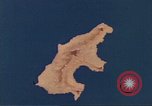
Animated map shows a mountainous ridge and a road network in Saipan, Mariana Islands.
Animated map gives geographical details of Saipan, Marian Islands. A mountainous ridge across the island shows Mount Topatchau, Mt. Marpi, Mt. Kagman and Mt. Nafutan. The map shows the Charan-Kanoa Marsh. Animation shows sugarcane plantations across the island. A road network shows Karaberra Pass, Flores Point, Charan Kanoa. Pictures of Japanese civilians in Kanoa.
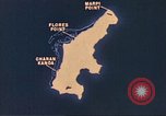
Animated map shows various air strips Marpi Point, Flores Point and Charan-Kanoa on Saipan, Mariana Islands.
Animated map gives geographical details of Saipan, Marian Islands during World War II. Animation shows air strips named Marpi Point, Flores Point and Charan-Kanoa. An aerial view pictures of Japanese held area on Saipan.
Animated map show U.S. forces landing on Saipan, Mariana Islands.
Animated map shows Saipan, Marian Islands. Animation shows U.S. forces acquiring the island from the Japanese during World War II. Advancement of Task Force 56. The 77th Infantry Division at Oahu. The 2nd and 4th Marine Division land on the island on the orders of a United States General. Animation shows the 37th Division troops landing on a beachhead from ships.
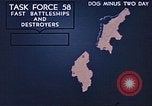
Animated map U.S. forces approaching and bombarding a beachhead in Saipan, Mariana Islands.
Animated map shows Saipan, Marian Islands. Animation shows U.S. forces acquiring the island from the Japanese during World War II. Advancement of Task Force 58 with battleships and destroyers. Animation shows bombardment by Group 1 and Group 2 on the island. Fire Support Units fire at the Japanese. The gun boat support group advances towards the beach.
Animation shows U.S. aircraft bombing Saipan, Mariana Islands during World War II.
Animated map shows Saipan in the Marian Islands. Animation shows U.S. forces acquiring the island from the Japanese during World War II. Pictures of American ships approaching the island. Marines aboard a ship look at maps. Animation shows United States aircraft bombing Saipan island.
Animation and pictures show U.S. forces advancing and capturing a radio station on Japanese acquired Saipan, Mariana Islands.
U.S. forces advance towards Japanese acquired Saipan island in the Mariana Islands during World War II.. Pictures of United States ships arriving at a target area. Fire and explosions on the island. A soldier fires a rifle. A Marine holds a land mine in hand. Animation shows U.S. forces approaching the island. They capture a radio station . A fleet of ships underway.