


 Francais
 Deutsch
 Italiano
Refine Your Search
Adak Alaska USA 1943 stock footage and images
- Showing 547 to 552 of 27381 results more
more Hide
Hide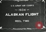
The USAAC Alaska Flight of 1934, progresses through Edmonton and Prince George, Canada
Animated map shows propsed course of the U.S. Army Air Corps (USAAC) Alaskan flight, originating in Washington, DC, United States, and heading northwest, across North America, to Alaska. It shows progress to Edmonton, Alberta, Canada. Next, Canadians are seen waving skywards, and scene shifts to aerial views of the expedition's Martin YB-10 aircraft flying in formation. On the ground at Edmonton, a Royal Canadian Mounted Policeman (RCMP) sits on horseback and talks with one of the fliers. A large crowd of visiters surround YB-10 aircraft parked on display, at an airfield. Several RCMP on horseback patrol the area. The animated map tracks the Alaskan Flight to Prince George, Canada. YB-10s are seen again, flying in formation. View out window of one showing snow-covered mountains.
The icebreaker, USS Burton Island, leaves San Diego on ice reconnaissance cruise to King Island, Alaska
A film titled' Icebreaker' about the journey of the icebreaker, USS Burton Island (AGB-1) to King Island, Alaska as a part of U.S. Navy annual winter ice reconnaissance program. Skyline of San Diego, California as the USS Burton Island leaves the harbor. Ship underway at sea. Crew member securing items on deck. Commander Everett A. Trickey, U.S.N, Captain of the ship works on a map. Animated map shows the route taken by the USS Burton Island to reach King Island. Helmsman steers the wheel of the ship. Ship underway at rough sea. Water washes over the deck of the ship.
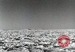
The icebreaker, USS Burton Island, breaking her way through ice sheets Northeast of St. Lawrence island, Alaska
The icebreaker, USS Burton Island, heading Northeast from St. Lawrence Island, Alaska, through ice field. View from bow, as she follows "groove" where ice field has separated and refrozen enabling the icebreaker to easily make way. As she progresses, the ice thickens and she slows, until the USS Burton Island finally stops. The ship's helicopter cranks up and warms up preparing to scout out easier pathways through the ice field. View from the low-flying helicopter, of a polar bear moving across ice flows. view of the icebreaker from returning helicopter. Since no "leads" could be found, the ship must use engine power. View of the engine room where sailors start more engines to increase the icebreaker's driving power. The icebreaker backs down from the ice sheet, and then as Captain calls for more forward power, a sailor on deck advances control, and the ship begins to break her way forward, through the ice.
U.S. aircraft take off and U.S. Army officers in the Aleutian Islands, Alaska.
The Aleutian Islands Campaign of World War II. A map shows the Aleutian Islands situated in the North Pacific Ocean forming the southern boundary of the Bering Sea. Volcanoes in the Aleutian Islands. The rocky coast of the island. A man stands on an ice covered ship. A boat carries some people. An aircraft lands on sea. A ship in the rough seas. In 1942: Animated map depicts Japanese invasion of Midway Island and Dutch Harbor and U.S. response to the attack. U.S. Army Air Force PBY Catalina flying boat aircraft takes off. U.S. Army officers who participated in the Battle of Dutch Harbor include Lieutenants Charles H. Briggs, Jack Todd, Jep C, Jonson, James E. Breeding, Virgil Alleman and Jack S. Marks. Active volcanoes in the background. Army camps in the Aleutian Islands.

Equipment being unloaded with the help of a crane in the Aleutian Islands, Alaska during the Aleutian Islands Campaign.
The Aleutian Islands Campaign of World War II. U.S. Army Service Force (ASF) provides logistical support to fight the enemy. A flag of the United States. A United States Army Air Forces B-25 Mitchell bomber flies. Various goods like timber, vehicles being unloaded from a cargo ship with the help of a crane. A ship carries troops. Soldiers disembark from a ship. A soldier carries a guitar.
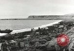
U.S. troops and supplies land at Attu Island in Aleutian Island, Alaska, during World War II
U.S. army troops and supplies being landed by Higgins boats at Massacre Bay, in preparation for battle to dislodge Japanese forces that invaded Attu Island in the Aleutians during World War 2. American forces landing at this Southern landing site included elements of the 17th and 32nd Infantry Regiments.. Troops and supplies are seen being brought to the shore by Higgins boats. Boxes of supplies are piled up and several Higgins boats are beached, including one from the Attack Transport Ship, USS Barnett (APA-5) and one from the USS Zeilin (APA-3). Weather is bleak and snow covers mountains in background. Most of the supplies are in wooden crates. Some building materials are also seen. There is no sign of Japanese resistance. The Higgins boats, aka Landing Craft, Vehicle, Personnel (LCVP) are shuttling back and forth from the attack transports seen anchored offshore. As the sequence progresses, more and more troops and supplies are seen on the beachhead. Troops form a chain to unload cargo from the landing craft. U.S. army troops and supplies being landed by Higgins boats at Massacre Bay, in preparation for battle to dislodge Japanese forces that invaded Attu Island in the Aleutians during World War 2. American forces landing at this Southern landing site included elements of the 17th and 32nd Infantry Regiments.. Troops and supplies are seen being brought to the shore by Higgins boats. Boxes of supplies are piled up and several Higgins boats are beached, including one from the Attack Transport Ship, USS Barnett (APA-5) and one from the USS Zeilin (APA-3). Weather is bleak and snow covers mountains in background. Most of the supplies are in wooden crates. Some building materials are also seen. There is no sign of Japanese resistance. The Higgins boats, aka Landing Craft, Vehicle, Personnel (LCVP) are shuttling back and forth from the attack transports seen anchored offshore. As the sequence progresses, more and more troops and supplies are seen on the beachhead. Troops form a chain to unload cargo from the landing craft.
CRITICALPAST.COM: About Us | Contact Us | FAQs - How to Order | License Agreement | My Account | My Lightboxes | Shopping Cart | Advanced Search | Featured Collections | Website Terms & Conditions | Privacy Policy ©2026 CriticalPast LLC.
License Agreement |
Terms & Conditions |
Privacy Policy
©2026 CriticalPast LLC.