


 Francais
 Deutsch
 Italiano
Refine Your Search
B-24-Burma stock footage and images
- Showing 565 to 570 of 3692 results more
more Hide
Hide
U.S. soldiers with ox carts moving along a narrow muddy jungle road in Chaungtha, Burma.
101st Detachment of Karen troops in Chaungtha, Burma during World War II. Karen troops pull a cart on a pontoon bridge. The troops haul cart across the bridge. A Burmese native on an ox cart. He pulls away the oxen from the cart. The man takes the oxen across the bridge. Few of the U.S. soldiers with ox carts moving along a narrow muddy jungle road. T hey get off from the carts. The troops moving in carts.
C-47 drop rations for Karen troops in a jungle and laborers supervised by soldiers carry supplies from drop zone in Burma.
101st Detachment of Karen troops in Chaungtha, Burma during World War II. U.S. Army Air Force C-47 Skytrain in flight. The aircraft drops rations for Karen soldiers in a jungle. Several view of aircraft in flight dropping food supplies. Burmese workers being supervised by soldiers carry supplies from drop zones. The coolies carry food supplies using a wooden stick. A laborer tying supplies on a stick. They carry food supplies on the stick. The laborers collecting supplies at a particular place in the jungle.
A small detachment of Karen troops leave native village and walk along a jungle trail in Chaungtha, Burma.
101st Detachment of Karen troops in Chaungtha, Burma during World War II. A small detachment leaving their native village The troops carrying guns on their shoulders walk in a jungle. The troops advancing in the jungle. A close up of the troops advancing with guns. They cross a fording stream. The troops crossing the stream. The troops walk along a jungle trail.
The Karen troops on tanks ford a stream and the troops on foot follow the tank in Chaungtha, Burma.
101st Detachment of Karen troops in Chaungtha, Burma during World War II. The troops walk on a dirt road. The Karen troops on tanks roll down a muddy road. The troops on tank ford a stream. The troops follow the tank.
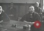
China builds Burma Road to carry war materiel and supplies and creates flood of Yellow River to thwart Westward expansion of Japanese occupied territory
Japanese officials meeting in strategy session. Japanese infantry on mission to cut Chinese supply lines during 2nd Sino-Japanese war. Black smoke rises as they move along a river bank. Chinese prisoner-workers are forced to rebuild railroads destroyed by the Chinese people during their great Westward trek. Japanese soldier closely guards workers. A Japanese army armored train underway on the rebuilt railroad, as Japanese soldiers cheer. Animated map shows China's supply lines by sea, to Tsingtao, Hangchow, and Amoy, cut off by Japanese naval blockade. Japanese Navy launch with officers and crew moving near commercial ships as they take over Chinese river ports. War materiel and other supplies destined for China, including trucks, sit idle, unable to be transported to their destinations. Large oil tanks and drums of gasoline are shown, as well as gun barrels and a flightline filled with parked Curtiss P-36 Hawk aircraft. The Imperial Japanese Navy destroyer Asakaze (DD-3) and another, next to it, in a Chinese river port. A Japanese freighter with anchored weighed, secured by long lines to a wharf. Small boats flying Japanese Naval ensigns are next to it. View of map showing china, Burma, Indo-China, and Chungking, with Japanese blockading fleet stationed in the South China Sea. It traces path of narrow gauge rail line from Indo-china to Kumming,China, where it connected to an overland road to Chungking. Next it traced the old Camel Caravan route, across China, from Russia. Narrator notes these were to small to be useful and too close to Japanese-occupied territory. Next, the map traces a railroad that from the port of Rangoon to Lashio, Burma. It is separated from the road to Chungking, by mountains and gorges. Views of the actual mountainous terrain. Animal pack trains moving through the area. Construction engineers in a large drafting room designing a road to transit the area. View of modern road-building caterpillar tractor equipment of the type needed to accomplish this. View of Chinese laborers using manpower instead. They push large rollers and employ pickaxes and other hand-held tools to carve away and dig road beds. Masses of Chinese laborers at work, carving a road along the edge of a mountain. Two-men teams using manual tampers to pound down the roadbed. Children are employed along with adults. A woman with a baby on her back, pounding large rocks into gravel, surrounded by other children doing the same. View from above of the "Burma Road," the product of their labors, winding its way through the mountains and gorges. Many scenes of trucks moving along portions of the Burma Road. P-40 airplanes flying past white cumulus clouds, overhead. Animated map shows continued expansion of Japanese occupied areas to encompass two thirds of the rail lines in China with goal of controlling the remainder, starting at Chengchow, in Summer, 1938. View of Chengchow region, on banks of the Yellow River. Map illustrates flow pattern of the Yellow River. View from past of the Yellow River's Spring floods toward the Sea, with Chinese people throwing rocks onto dikes that keep the river flowing in a more Northerly direction than its former course. Illustration shows how with Japanese encrouching on Chengchow, the Chinese decided to destroy those dikes and allow the river to flood over its former more Southerly course. Japanese soldiers being inundated by the flooding river. Japanese infantry and tanks regrouping on their occupied side of the new (old) path of the Yellow River. Local Chinese residents of Chengchow, wade with belongings as they leave their flooded homes.
Chinese laborers build the Burma Road on the side of a mountain in World War II.
A film illustrates the importance of the Burma Road during World War II. The Burma Road is represented as a vital link between Lashio, Burma and Kunming, China during World War II. Chinese laborers are building the Burma Road. A laborer hammers a rock. Trucks move along a mountain road. Chinese men and women farmers work on a farm.
CRITICALPAST.COM: About Us | Contact Us | FAQs - How to Order | License Agreement | My Account | My Lightboxes | Shopping Cart | Advanced Search | Featured Collections | Website Terms & Conditions | Privacy Policy ©2026 CriticalPast LLC.
License Agreement |
Terms & Conditions |
Privacy Policy
©2026 CriticalPast LLC.