


 Francais
 Deutsch
 Italiano
Refine Your Search
F-86 stock footage and images
- Showing 127 to 132 of 2472 results more
more Hide
Hide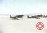
Formations of U.S. Army Air Forces A-36 Invader dive bombers over Sicily during World War II.
U.S. Army Air Forces A-36 Invader dive bombers of 86th Fighter Bomber Group in Sicily during World War II. Flight line of A-36s on an airfield in Sicily. A-36s taxis. Formation of A-36s over clouds. A-36s dive. Five A-36s in flight and clouds in the background. Aerial view of countryside.
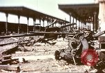
Damage caused to a railroad station by bombings done by A-36 Invader dive bombers over Sicily during World War II.
A railroad station in Sicily after bombings by U.S. Army Air Forces A-36 Invader dive bombers of 86th Fighter Bomber Group during World War II. Damage caused to railroad station with debris spread around th station. Sign reads 'Taormina-Giardini'. U.S. soldier inspects a railroad car. Damaged locomotives and railroad cars.
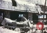
Aftermath of U.S. Army Air Forces bombing in Messina, Sicily (WW2)
Messina railway station and port in Sicily after bombings done by U.S. Army Air Forces A-36 Invader dive bombers of 86th Fighter Bomber Group during World War II. Damage caused to harbor area with debris outside a building. A painting shows Italian Prime Minister Benito Mussolini. Interiors of a building. Bombed building and harbor facilities. U.S. soldier stands next to Nazi German NSV sign (National Socialist People's Welfare Organization) identifying a service station. He looks at a booklet, perhaps to translate the sign (bahnhofsdienst). More views of destruction from the bombing.
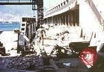
United States soldier inspects damages caused by A-36 bombings in harbor area of a town in Sicily during World War II.
Damages in Sicily after bombings done by U.S. Army Air Forces A-36 Invader dive bombers of 86th Fighter Bomber Group during World War II. U.S. soldier stands amidst debris in harbor area. Soldier inspects abandoned guns. Soldiers looks at wrecked vehicles and climbs on one of the vehicle. Wreckage of equipment and harbor facilities. Debris burn.
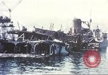
Destruction at Messina harbor and ferry terminal from U.S. bombing in World War II
Scenes of destruction at the Messina harbor and ferry terminal, in Sicily, in the aftermath of attacks by bombers of the U.S. Army Air Forces 86th Fighter Bomber Group in World War 2. Views of destroyed ferry boats. Interior of one ferry, with superstructure beams hanging down, and charts, maps, books, and furniture strewn about and partially underwater. View topside of complete distruction. A sign posted in German warns that photographing of the ferry to and from the port area is strictly prohibited. Destroyed rail cars at the port. Pieces of field artillery mixed with debris. A destroyed ferry slip.
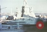
Italian workmen clear debris in front of bombed out building in Sicily during World War II.
Damages caused in Sicily after bombings by U.S. Army Air Forces A-36 Invader dive bombers of 86th Fighter Bomber Group during World War II. Bombed out monument and statue in a port town of Sicily. Italian men pose. Damaged buildings. Italian workmen clear debris in front of a large building.
CRITICALPAST.COM: About Us | Contact Us | FAQs - How to Order | License Agreement | My Account | My Lightboxes | Shopping Cart | Advanced Search | Featured Collections | Website Terms & Conditions | Privacy Policy ©2026 CriticalPast LLC.
License Agreement |
Terms & Conditions |
Privacy Policy
©2026 CriticalPast LLC.