


 Francais
 Deutsch
 Italiano
Refine Your Search
Goodenough Island New Guinea 1943 stock footage and images
- Showing 2689 to 2694 of 13658 results more
more Hide
Hide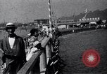
Western tourists visit Enoshima in Japan.
Tourists visit Enoshima Island, Kamakura County, Kanagawa Prefecture, Japan. Western tourists at bridge over Enoshima Seashore between Enoshima Beach and Enoshima Island and look at boats. Boats are moored at the jetty of Enoshima Island. Tourists walk down the bridge. View of Enoshima East Beach and hills in the background. Traditional wooden inns (called ryokan) at both sides of the narrow entrance path to Enoshima Shinto Shrine (2 Chome-3-8 Enoshima, Fujisawa, Kanagawa 251-0036, Japan) at the hilltop of Enoshima Island. A man fanning his daughter inside a ryokan inn.
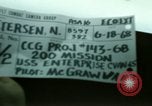
Pilot McGraw's 200th mission. He flies A-4F aircraft from USS Enterprise in Gulf of Tonkin Vietnam.
USS Enterprise (CVAN-65) during mission in Gulf of Tonkin during Vietnam War. Several aircraft, sailors and other crew members on the deck area near the ship's island structure. Number 65 in bold written on the lower portion of ship's island and A-4FSkyhawk aircraft moving on the deck. Pilot McGraw walks from the ship's island towards another aircraft parked on the deck. Lieutenant Michael McGraw inspects the aircraft engine and climbs up the port side to check the air intake. He gets inside the cockpit, tightens shoulder harness, wears helmet, shuts the canopy and takes off. Two A-4F Skyhawk aircraft landing and several other aircraft parked in background. Pilot McGraw steps down the aircraft ladder, walks with Commander Robert J. Thomas, commanding officer of attack squadron 113 who congratulates him on his 200th mission. Pilot McGraw walks on the deck passing by several aircraft parked near the ship's island. Another crew member lying and relaxing on the deck.
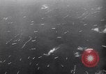
Aerial view of boats and ships advancing during the battle of Iwo Jima in Japan.
Aerial view of ship fleet in water during the battle of Iwo Jima in Japan. A ship and other ships and boats in water. A plane launched. Large clouds of smoke behind plane. Aerial views of boats. A fleet of boats in advances in sea. Aerial views of boats. Boats reach island. U.S. soldiers of 5th Marine Division in a LVT (Landing Vehicle Tracked). Aerial view of boats and ships advancing. U.S. soldiers pushing a tank in shore area of island. Scene of a crane. A U.S. soldier runs and comes to another soldier. A U.S. soldier doing bandage on leg of a soldier and others helping him. Japanese men captured by U.S. soldiers. A Japanese soldier tries to climb a boat and the U.S. soldier takes him up. Scene of a U.S. soldier climbing LVT. U.S. soldiers advance towards island. Military vehicles advance. Scene of military vehicles through a tank's window. Scene of a bomb explosion. U.S. soldiers fire and hide at a slope. A ship in the sea. Firing by guns of the ship. Planes drop bomb. Aerial view of boats in sea. Scene of bomb explosion. A U.S. tank and soldiers advance on a hilly terrain. Scenes of firing. Wreckage of a crashed plane on ground seen. Firing by a tank as seen through the window of the tank. Soldiers coming out of a bunker. A U.S. soldier checks his rifle. A soldier gets up and runs. Firing by a tank. Scenes of bombing on the shore areas of the island. (World War II period).
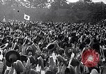
U.S. war effort is concentrated against Japan after the fall of Nazi Germany in World War II
Overlaid on scenes of fervently patriotic Japanese people waving flags and cheering, is slate reading: "Japan is firmly determined to fight a hundred years war to crush the United States." A huge explosion. Glimpse of U.S. Marine Flame Thrower Tank M67 directing flame on a Japanese bunker. U.S. marines charging in an amphibious assault on a Japanese held Pacific Island during World War 2. U.S. troops wading through surf from their landing craft, during amphibious assault. Marines fighting Japanese in Pacific Island jungle. Landing craft at beach in background. American flag being raised on a palm tree. Soldier saluting the American flag. General Douglas MacArthur wading ashore in the Philippines followed by staff officers and soldiers, including Filipinos. U.S. aircraft bombing Japanese held Corregidor in the Philippines. U.S. Navy ships bombarding the Philippine coast. American paratroopers of the 503rd Parachute Infantry Regiment, jumping at low altitude, from C-47 aircraft onto a critical hill known as "Topside" on Corregidor. Views from ground of paratroopers descending. and landing at the hilltop. U.S. troops in an amphibious assault, under fire. The American flag being formally raised as General MacArthur and other officers salute the flag. Marines in amphibious assault on Iwo Jima. A U.S. battleship firing at the coast. Explosions along the coast from Naval bombardment. Marines charging across the black sands of Iwo Jima. Marines firing a 75mm Pack Howitzer M1. Shells exploding at the base of Mount Suribachi. The famous flag raising by Marines on Iwo Jima. American forces attacking the Japanese Island of Okinawa. A Landing Ship Medium (R) firing rockets at Okinawa. Numerous explosions ashore. The USS LSM(R)-198 firing rockets. U.S. troops using a flame thrower to attack Japanese troops in a bunker. A Japanese defender is shot and tumbles down a hill from a fortification. American flag raising on Okinawa. Army officers salute the colors. A U.S. Navy destroyer firing its stern 8-inch guns. A Japanese warship struck by a bomb or shell, with flash of fire and explosion. More views of U.S. Navy warships bombarding Okinawa. A torpedo seen below the water as it is launched A Japanese ship exploding with fireball and huge cloud of smoke. Glimpse of helmsmen inside U.S. submarine. A formation of Douglas SBD Dauntless Dive Bomber aircraft peels off, and dives. A Japanese ship being strafed and bombed. It explodes. U.S. Army Air Forces B-29 bomber aircraft taking off from captured islands to attack Japan. A formation of B-29s in flight. B-29s flying over Japan. Mount Fuji is visible. B-29 raining bombs on Japan. View from aircraft as bombs strike, exploding on ground. Closeup of falling bomb. Huge clouds of smoke rising from struck targets. More views of B-29 aircraft in flight. Some leaving contrails at high altitude. View from bridge of U.S. battleship bow plunging into heavy seas that cover deck. (Ship's forward triple gun turrets are visible.) Aerial view of landing craft speeding toward a beach, leaving white wake in water. Glimpse of U.S. battleship, in camouflage paint, bombarding a shore. Closeup of twin 40mm Bofors anti aircraft guns being fired from U.S. Navy ship. A Japanese Kamikaze airplane on fire, falling through flak clouds. A Japanese Mitsubishi G4M bomber aircraft flying low past a U.S. Aircraft Carrier. U.S. Navy sailors on a ship's deck firing a twin 40mm bofors gun. A Japanese Kamikaze airplane hit and in flames as it falls. A squadron of U.S. aircraft in formation. Gun camera film of Japanese airplane bursting into flames while being shot at by U.S. aircraft. Flaming aircraft falling straight down towards the water and splashing on contact. U.S. troops wade through surf as they leave Landing Ship Infantry Large USS LCI(L)-337. Troops rush past a beached Landing Vehicle Tracked (LVT) on sand beach. Troops in tracked landing vehicles approaching the shore from a cove. White smoke in the area. A banner erected at shore reading: "CIC." Explosions nearby. Soldiers using a flame thrower. Scene shifts to U.S. Secretary of War, Henry Lewis Stimson, speaking from his office in Washington, DC. He speaks of destroying Japan's armed forces and war fighting capability. A soldier shouting with a beached LVT behind him. American soldiers firing small arms from sheltered positions. An artillery soldier closing the breech of a heavy gun after loading it. Montage of scenes similar to all seen already. A liberty bell and "V" for victory is shown.
United States Navy's radioman, George Tweed is rescued and U.S. destroyer crew in Guam.
Film titled, 'Return to Guam'. Map shows location of Guam in the Pacific Ocean. Japanese installations on the island are shelled by American destroyer (DD). Light flashes are noticed on a peak of a nearby hill on the island. Sailors aboard the DD look through binoculars. A reply signal is sent form the DD. Sailors board a boat and head cautiously toward the island. A white man swims toward the boat. He is taken aboard. The rescued man was found to be a radioman of the United States Navy (USN), named George Tweed who was hiding on the island for the past 31 months. George Tweed eats food with the Destroyer crew after being rescued. Destroyers underway in the Pacific. View of the American naval fleet underway in the Pacific. View of cannons and crew aboard an allied vessel. Crewmen pile up heavy 14inch shells and 40mm ammunition on the deck of the warship. (World War II period).
As the United States enters World War II, U.S. military forces are seen, deployed in various places throughout the world.
American troops are seen in arctic gear moving on skis through blustery snowy weather in Iceland, during World War 2. They were sent in 1941 to relieve British troops occupying Iceland since 1940, during World War II. A guard post at the American camp, with Quonset Hut in background. Closeup of U.S. sentry in arctic gear holding rifle with bayonet affixed. View from above, of numerous tents partially covered with snow in the American camp. Change of scene shows U.S. troops disembarking from transport ships at the British Isles. They march with their combat gear onto a square where Army trucks wait to transport them inland. Another scene shows the American troops, viewed from behind, parading in London. Other scenes show them marching in various areas of London. Saint Paul’s cathedral is seen in the background of one scene. A large number of American M3 Stuart Light tanks move on a railroad train in Britain. Scene shifts to the Middle East, where railroad cars and various military supplies for Russia are be offloaded from American ships. A Russian officer is seen signing receipts for war materiel, from a U.S. Army Technical Sergeant. A row of American Army trucks are lined up behind them. The Russian and American exchange salutes, and shake hands. Next, a troop ship carrying American troops is seen arriving at a port in India, where they disembark with their gear. An American Army Sergeant in a pith helmet pays attention to a little Indian girl. Scene shifts to China, in 1942, where Brigadier General Claire Lee Chennault, Commander of the China Air Task Force, of the Tenth Air Force, that replaced the American Volunteer Group (Flying Tigers), is seen with Brigadier General Caleb V. Haynes, Commander of the India Air Task Force. A colonel joins their discussions. A Consolidated B-24 Liberator bomber is parked behind them. View of Curtiss P-40 Warhawk fighter planes, with Flying Tiger markings, parked on a flight line. A B-24 bomber landing on a runway, between hills, deep in China. Closeup of Nationalist China Generalissimo Chiang Kai-Shek, saluting. Huge numbers of Chinese troops assembling in a formation. Next, an expeditionary force of American troops is seen arriving on a troop ship in Australia. They line the ship’s deck and wave. General Douglas MacArthur arriving in Australia to assume the office of Supreme Commander, South West Pacific Area (SWPA). .Glimpses of U.S. Navy activities in Australia: setting up defenses of islands; unpacking a Kingfisher float plane and making it ready for use on a desert island. The final segments of the film show American forces in August ,1942 sailing to Adak in the Aleutian Islands, to strengthen American defenses there. Troops seen descending by rope ladder from the American transport ship USS J Franklin Bell (PA-34), into her landing craft for deployment on Adak Island. Scenes of landing craft reaching the beach and offloading troops, vehicles, and supplies. View of beach filled with supplies. One landing craft is clearly marked with ""P34" showing that it belongs to the USS J Franklin Bell ( later reclassified as APA-16).
CRITICALPAST.COM: About Us | Contact Us | FAQs - How to Order | License Agreement | My Account | My Lightboxes | Shopping Cart | Advanced Search | Featured Collections | Website Terms & Conditions | Privacy Policy ©2026 CriticalPast LLC.
License Agreement |
Terms & Conditions |
Privacy Policy
©2026 CriticalPast LLC.