


 Francais
 Deutsch
 Italiano
Refine Your Search
Kiska Aleutian Islands Alaska 1944 stock footage and images
- Showing 301 to 306 of 9823 results more
more Hide
Hide
The Alaskan Flight crew visits a gold mine in operation near Fairbanks, Alaska.
(Soon after passage of the Gold Reserve Act in the United States, establishing a much higher price for gold): Alaskan scenes photographed by cameraman with the U.S. Army Air Corps' 1934 Alaska Flight. Placer mining for gold, near Fairbanks, Alaska. Heavy stream of water directed at edge if a stream, to wash away loose dirt and expose more stable layers of gravel, where gold may be found. Views of channels cut from the high pressure hose. A giant dredge that operates 24 hours a day, digging up riverbed to depth of 30 feet, sifting out heavier material (gold) and discharging the tailings behind, as it moves along. Closeup of the dredge. Steel buckets connected to a conveyer, being raised in the process. A pet black bear cub playing in a tub of water and later, in a tree. Two Bear cubs playing in a tree.
Residents of Fairbanks Alaska enjoy their summer resort at Lake Harding.
Some scenes of Fairbanks Alaska and environs filmed by cameraman accompanying the U.S. Army Air Corps' 1934 Alaska Flight. A very tall pole with radio antenna, surrounded by smaller poles holding antenna wires for radio reception. A road through pine forest leading to the Fairbanks summer resort at Lake Harding. View from motor vehicle traveling along the road. It passes around another vehicle stopped in the roadway. View of the lake, with a floatplane resting in the water. Youngsters in bathing attire playing in the lake waters. A small tree house near a large log home in woods near the lake.
Aircraft of the 1934 U.S. Army Air Corps Alaska Flight depart Fairbanks for Anchorage..
YB-10 aircraft of the U.S.Air Corps 1934 Alaska Flight heading to Anchorage, Alaska. View of one of the aircraft as it takes off from Fairbanks. View out the window of one B-10, as another moves into formation off its left wing. Views from various angles in the airplane. Views of Anchorage, below. aircraft in formation passing over the Anchorage airfield. The camera airplane setting up on downwind leg to the field. Glimpse out right side window over the wing as the aircraft is on final approach near the field. YB-10s parked on Anchorage airfield, with lots of spectators and well-wishers to greet the fliers. Another B-10 landing, as Lieutenant Colonel Henry (Hap) Arnold and Major Ralph Royce watch, along with other fliers. The newly arrived B-10s taxiing to park. Panning view of the airfield, with B-10s parked in a line and spectators standing scattered about in the field. Mountains in background
Boats to asses damage and rescue personnel along with oil offloaded from Exxon Valdez in Prince William Sound, Alaska.
Exxon Valdez oil spill in Prince William Sound in Valdez, Alaska. A sign on a building reads 'Coast Guard Vessel Traffic Center Marine Safety Office Valdez Alaska'. A car parked outside the building. Captain of the Coast Guard Commander Steven McCall explains a chart. Aerial view of the tanker terminal. A tug boat to asses the damage. A silver bullet boat to rescue the personnel aboard the oil tanker. Skimmers and tanks prepared. Oil spilled in Prince William Sound. Coast guard personnel on the oil tanker to asses the damage. The Exxon Baton Rouge attempts to offload crude oil from the Exxon Valdez in the Prince William Sound. A small boat near the ship.
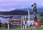
South Eastern areas of Alaska where totem poles are made.
Landscape and natural terrain views of Alaska, areas of South Eastern Alaska and Tongass National Forest where native indigenous indian totem poles are made are shown. View of glaciers across water. Two women walk away from a small PanAm passenger airplane on an airfield in Alaska. Aerial views of snow covered mountains, and wooded mountains and lakes in Alaska. Harvested wood timber floating in large pens in waterways of Alaska. Fishing boat and hauling in a large catch of salmon fish by net. View of waterfall. Mountain and lake scene at sunset.
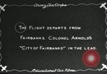
YB-10s of the U.S. Army Air Corps 1934 Alaska Flight return to Bolling Field in Washington, DC after flying more than 7000 miles.
The U.S. Army Air Corps (USAAC) Alaska Flight of 1934 departing Fairbanks Alaska on flight back to Washington, DC. Their YB-10 aircraft are seen in a line on the airfield. Spectators are at the edge of the field to see them off. Next, the aircraft are seen taxiing out for takeoff, with their Commander, Lieutenant Colonel Henry Arnold, piloting the lead aircraft, the "City of Fairbanks." Other aircraft follow in succession. Colonel Arnold's airplane takes off and proceeds in a shallow climb. Slate tells first leg is 640 miles to Juneau in 3 hours and 55 minutes. Map shows North America with outbound course to Alaska from Washington, DC, traversing the Great Lakes, Edmonton, Prince George, and White Horse, to Fairbanks. But a moving arrow shows return route via Juneau. Snow-covered mountains seen from a YB-10 on this return leg. Aerial shots of several YB-10s in formation. Slate announces next leg as 940 miles and 5 hours and 40 minutes to Seattle, Washington State. Aircraft and crews of the returning Alaska Flight, seen on a grass field in Seattle. Lieutenant Colonel Henry Arnold, expedition commander, leads his fliers across the field. Slate states remaining distance to Washington, DC, as 2700 miles and 14 hours. More shots of YB-10s in formation aloft. Shot of a YB-10 with farmland below. Ten YB-10s seen in formation, and the animated map completes the journey to Washington, DC. Aerial view from above of several YB-10s below, flying over the Potomac River, in Washington, DC, with the Lincoln Memorial, and Arlington Memorial bridge visible below. The formation of 10 planes barely visible above the Capitol building. The YB-10 named Juneau, taxiing across Bolling Field, after landing. (This segment of film is reversed, so the name and Alaska Flight logo are mirror-reversed.) The last of the 10 aircraft pulls into position on the flightline. Lieutenant Colonel Henry (Hap) Arnold stands in front of his fliers who hold a large totem pole souvenir. Secretary of War, George H. Dern, greets the returning aviators and poses next to Colonel Arnold.
CRITICALPAST.COM: About Us | Contact Us | FAQs - How to Order | License Agreement | My Account | My Lightboxes | Shopping Cart | Advanced Search | Featured Collections | Website Terms & Conditions | Privacy Policy ©2026 CriticalPast LLC.
License Agreement |
Terms & Conditions |
Privacy Policy
©2026 CriticalPast LLC.