


 Francais
 Deutsch
 Italiano
Refine Your Search
Melville Rhode Island 1943 stock footage and images
- Showing 391 to 396 of 6726 results more
more Hide
Hide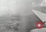
Aerial views of ships at Leyte Gulf, Peleliu Island and airstrip on Biak Island (WW2)
Aerial views of ships at Leyte Gulf, Philippines during World War II. Interiors of C-47 Skytrain shows radio operation, Pilot, Copilot, and Navigator work inside aircraft. Pilot looks through binoculars from the cockpit. Aerial views of Peleliu Island, Palau and airstrip on Biak Island.
Several B-29s fly in a formation over Rota Island in Guam, Mariana Islands.
United States Army Air Forces ( USAAF ) 29th Bombardment Group in Guam, Mariana Islands during World War II. An aerial view of USAAF B-29 Superfortress aircraft in flight over Rotal Island. Several B-29s fly in a formation. A B-29 parked on an airfield. The crew of the B-29 prepares for a flight.
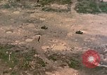
Aerial view of army vehicles and men advancing across Engesebus Island in Peleliu, Palau Islands.
The Peleliu operation in Peleliu, Palau Islands during World War II. Aerial view: The tanks and men advance across Engesebus Island. Landing boats go across a lagoon. Shell holes due to bombardment. M-4 tanks and amphibious tractors. Men get out of the amphibious tractors and run inland. Fire as a tank moves in the background.
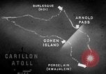
Information about arms, ammunition and equipment used to fortify various islands of the Marshall Islands is given.
A training film on operations of U.S. forces on Kwajalein Atoll in the Marshall Islands during World War II. Animated map of Kwajalein Atoll locates Cohen Island, Porcelain, Arnold Pass and Burlesque Island. Major air facilities are on Burlesque Island and Porcelain. Guns, machine guns, defense installations, artillery, trenches, anti tank ditches, barricades and embankments are used to fortify Burlesque Island. Burlesque and Camouflage Islands are located. Camouflage Island is the most strongly defended island. Abraham, Allen, Andrew and Anton Islands also had gun emplacements. On Allen Island are three tower radio station. On Jacob Island is a radar installation.
Amphibious vehicles land and U.S. Marines are attacked by Japanese snipers on Rendova Island, Solomon Islands.
Propaganda film 'The Price of Rendova' documents the taking of Rendova Island in the Solomon Islands during World War II. A naval task force assembles at Guadalcanal. Cargo is hoisted. Animated map shows the strategic importance of Rendova Island and that it is taken in order to facilitate operations against the air base at Munda. General MacArthur with other officers. Face of older officer. Big naval guns fire. Faces of tired and worried G.I.s. Landing crafts with soldiers are unloaded from a ship and they move towards Rendova Island. Amphibious vehicles land on the island. Troops take positions on the island. The island is covered with tall trees. Marines are attacked by Japanese snipers. The troops advance on the island. Coconut logs on the ground. The troops fire artillery. Explosions occur and smoke rises. Dead Japanese soldiers on the ground. Soldiers talk on a radio device. Signal officers wave semaphore flags to signal the troops on a beachhead. Essential materials needed for war, medical supplies and food are unloaded from a ship onto the landing crafts.
U.S. aircraft take off and U.S. Army officers in the Aleutian Islands, Alaska.
The Aleutian Islands Campaign of World War II. A map shows the Aleutian Islands situated in the North Pacific Ocean forming the southern boundary of the Bering Sea. Volcanoes in the Aleutian Islands. The rocky coast of the island. A man stands on an ice covered ship. A boat carries some people. An aircraft lands on sea. A ship in the rough seas. In 1942: Animated map depicts Japanese invasion of Midway Island and Dutch Harbor and U.S. response to the attack. U.S. Army Air Force PBY Catalina flying boat aircraft takes off. U.S. Army officers who participated in the Battle of Dutch Harbor include Lieutenants Charles H. Briggs, Jack Todd, Jep C, Jonson, James E. Breeding, Virgil Alleman and Jack S. Marks. Active volcanoes in the background. Army camps in the Aleutian Islands.
CRITICALPAST.COM: About Us | Contact Us | FAQs - How to Order | License Agreement | My Account | My Lightboxes | Shopping Cart | Advanced Search | Featured Collections | Website Terms & Conditions | Privacy Policy ©2026 CriticalPast LLC.
License Agreement |
Terms & Conditions |
Privacy Policy
©2026 CriticalPast LLC.