


 Francais
 Deutsch
 Italiano
Refine Your Search
Myitkyina Burma 1944 stock footage and images
- Showing 307 to 312 of 6869 results more
more Hide
Hide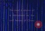
Chinese laborers build the Burma Road on the side of a mountain in World War II.
A film illustrates the importance of the Burma Road during World War II. The Burma Road is represented as a vital link between Lashio, Burma and Kunming, China during World War II. Chinese laborers are building the Burma Road. A laborer hammers a rock. Trucks move along a mountain road. Chinese men and women farmers work on a farm.
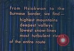
United States supply trucks move along the Burma Road in China.
A film illustrates the importance of the Burma Road in China during World War II. Animated map shows the Burma Road extending from Hsiakawan, China to the Burmese border. A truck moves along the Burma Road on the side of a mountain. A deep valley as seen from the Burma Road. U.S. supply trucks move along the road on the mountains.

U.S. supply trucks move along the Burma Road near Paoshan in Yunnan, China during World War II.
A film shows the Burma Road near Paoshan in Yunnan, China during World War II. Animated map shows the Burma Road and highlights Paoshan and Huitung Bridge. U.S. supply trucks moves along the road. Water of the Salween River flows over rocks. Chinese laborers stand along the Burma Road. A supply truck moves along the Burma Road on the side of a mountain.
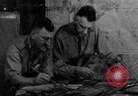
US General Joseph Stilwell with Major General Frank Dow Merrill; Allied soldiers in China Burma India Theater training in India during WW2
United States General Joseph Stilwell discusses plan with Major General Frank Dow Merrill during World War 2. Insignia of the China Burma India Theater (CBI). Nationalist Chinese soldiers march toward a United States Army Air Force transport plane to India. USA Army Air Force plane takes off, heading for India. At the U.S. Army Chinese Training and Combat Command at Ramgarh, India, Chinese soldiers train under the United States Army leadership. Aerial view of tents and buildings at Ramgarh. General Stilwell personally instructs Chinese soldiers as they shoot at targets while in prone position. Chinese troops charge out of a trench, crawl with guns under barbed wire, and avoid gun fire and explosions. India Command Formation insignia. British General Archibald Wavell inspects soldiers in formation. General Archibald Wavell shares a map with Field Marshal Claude Auchinleck, who was made Commander in Chief, India, for the British. British Indian soldiers seen in training, as they lift logs, jump over obstacles, climb ropes, and practice jumping from a parked airplane fuselage during parachute training. Next, soldiers are seen jumping out of an aircraft in flight with parachutes. British Indian soldiers descending with parachutes. United States soldiers unload supplies. Allied soldiers marching. Indian infantry marching in farmland. Gurkha soldiers from Nepal march with donkeys. Naga headhunters from Assam and northwestern Burma. East and West African soldiers. British colonial regiment, the Burma Rifles marching. Soldiers from the Kachin people of Burma and Southwestern China. Allied soldiers in India coming from various races- Scots, Irish, English, Welsh, Australian, New Zealander, Indian, Gurkha, Burman, African, Chinese and American. Multinational army from Allied countries.
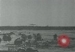
B-29 bombers of the 7th Bombardment Group, U.S. Army Air Force land at base after bombing in Burma during World War 2
China-Burma-India Theater during the World War II. B-29 bombers of the 7th Bombardment Group of the U.S. Army Air Force land one after the other at their base airfield in India. Landing after completing their mission of bombardment at the railroads in Burma. Taxi jeeps and people near the runway are visible. Puff of dust emerges as a B-29 lands on the runway.
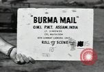
U.S. B-25 Mitchell bomber takes off from Assam to drop U.S. Office of War Information leaflets on Japanese troops in Burma.
Dropping of U.S. OWI (Office of War Information) leaflets by U.S. plane on retreating Japanese troops in Burma during World War II. U.S. Army Air Forces B-25 Mitchell bomber parked on airfield in Burma. Propellers turning. B-25 taxis and takes off from airstrip. B-25 flies over Burmese jungle.
CRITICALPAST.COM: About Us | Contact Us | FAQs - How to Order | License Agreement | My Account | My Lightboxes | Shopping Cart | Advanced Search | Featured Collections | Website Terms & Conditions | Privacy Policy ©2026 CriticalPast LLC.
License Agreement |
Terms & Conditions |
Privacy Policy
©2026 CriticalPast LLC.