


 Francais
 Deutsch
 Italiano
Refine Your Search
Okinawa Ryukyu Islands 1944 stock footage and images
- Showing 931 to 936 of 9549 results more
more Hide
Hide
Westinghouse ocean bottom scanning sonar equipment is lowered aboard a ship at Sao Miguel Island of the Azores Islands.
U.S. ships at Sao Miguel Island of the Azores Islands. Two small ships tied to a pier. A mobile crane on the pier loading equipment on a ship. Equipment coming aboard is Westinghouse ocean bottom scanning sonar. The equipment is lowered by the crane hook over the fantail of the ship. USS Preserver takes aboard the ocean bottom scanning equipment. USS Hoist is secured outboard of USS Preserver. Officers lean against gunwale aboard USS Compass Island. A steady line is attached to the cable directly above the crane hook. The ocean bottom scanning sonar is secured to a wooden platform setting on the deck. Some crewmen standing in the background on the deck of USS Compass Island. Insignia of Westinghouse painted on the side of the scanning sonar. Several crewmen move the scanning sonar platform into position for hoisting. Men spread out a cargo net.
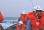
Crewmen help in the transfer of cargo from a boat to a ship at Sao Miguel Island in the Azores Islands.
U.S. ships at Sao Miguel Island in the Azores Islands. Crewmen in a boat underway. A crewman holds a walkie-talkie in hand. Two men in the background. The crewmen are wearing life-jackets and hard hats. USS Compass Island underway at sea in the background. USNS Mizar underway. A boat crew in a whale boat underway. USS Compass Island in the background. A small boat along the beam of USNS Mizar on the starboard side. A utility boat alongside the starboard side of USNS Mizar. A cargo net loaded with cargo is hoisted from the boat. Crewmen and a civilian using a dolly move equipment on the deck. An ocean bottom scanning sonar is situated on the deck of the ship.
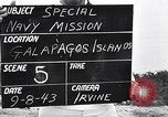
Vegetation on the island, beach and wharf and unloading of lumber at the Galapagos Islands.
U.S. Admiral Byrd's special navy mission in the South Pacific. Vegetation on the island. View of the island. Houses in the background. Beach and wharf at the island. Ships in the water. Unloading of lumber from a boat on the beach.
A section of a map shows the islands around Guam in the Mariana Islands
United States Army Air Force operations in the Mariana Islands during World War II. A section on a map of the South Pacific. The islands around Guam on the map.
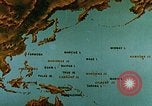
U.S. and Japanese Naval aircraft in aerial combat over the island of Kwajalein in the Pacific Theater during World War II.
The USS Yorktown (CV-10) in the Pacific Theater during World War II. Map of Marcus Island and surrounding islands in Japan. Animation depicts the U.S. fleet's aim to recapture the Philippines and land on the main land of Asia to help their ally China. USS Yorktown underway. A map depicts its advance towards its target of Kwajalein Island in the Marshall Islands. Imperial Japanese Navy Air Service Mitsubishi A6M Zero fighters in flight. U.S. planes in dogfights with Japanese aircraft over Kwajalein Island. Aerial gun camera footage shows United States aircraft attacking Japanese aircraft. Japanese airplane is hit and explodes. Another Japanese airplane falling from sky to crash in water. Heavy bombardment and strafing on land of enemy targets, wrecked aircraft. Black smoke rises from explosions on the burning island. Heavy shelling by surface ships. Assault crafts filled with U.S. Marines and Army soldiers hit the beaches on Kwajalein. U.S. airplanes in flight over the island.
The invasion of the U.S. troops on the Marshall Islands and destruction of Japanese garrisons during World War II.
U.S. troops' invasion on the Marshall Islands and destruction of Japanese garrisons during World War II. An animated map depicts the location of Marshall Islands in the South East Asia. U.S. Navy ships proceed in order to take the island from their enemies. The animated map depicts the tactics of U.S. Navy. The soldiers attack the Kwajalein Island. Roi and Namur in the north are attacked by the U.S. Marines. The U.S. fighter aircraft. Soldiers in small boats approach towards the Marshall Islands. Aerial bombarding on the island by the U.S. fighter aircraft. The American soldiers take their positions on the island's coast. Soldiers with their weapons. An officer examines the bomb explosion through binoculars. The remains of a destroyed Japanese aircraft. American soldiers capture the Japanese base headquarter. The dead Japanese soldiers. The arrival of more American troops on the island.
CRITICALPAST.COM: About Us | Contact Us | FAQs - How to Order | License Agreement | My Account | My Lightboxes | Shopping Cart | Advanced Search | Featured Collections | Website Terms & Conditions | Privacy Policy ©2026 CriticalPast LLC.
License Agreement |
Terms & Conditions |
Privacy Policy
©2026 CriticalPast LLC.