


 Francais
 Deutsch
 Italiano
Refine Your Search
Pleiku South Vietnam 1968 stock footage and images
- Showing 2227 to 2232 of 6036 results more
more Hide
Hide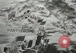
Montage of scenes depicting Allied advances through France and into Germany during World War II
Animated sequence shows flags of Allied forces advancing through France against German forces during World War 2. U.S. and Free French flags shown in South of France and British and Canadian to the North. Beyond the Seine River, German soldiers are seen watching the launch of V-1 buzz bombs against London. Aerial views of British armored units racing towards Brussels, Belgium. Local people wave and applaud them as they move through villages towards Brussels. Crowds greet them joyfully as they enter Brussels. American soldiers crossing fields and entering the boundaries of Germany. British soldiers (Tommies) being given drinks by Belgian man in Brussels. American soldier walking with another who is clowning around, wearing a top hat and carrying an umbrella. Line of surrendering German soldiers on bicycles. A German Army Division, of about 20 thousand soldiers marching along a road to surrender. Canadian troops advancing in the North, happen upon a deserted German "flying bomb" site. American P-51 fighters operating on a German airfield. African American U.S. Army troops setting up communications systems on poles. Allied troops being entertained by USO performer. British and American troops moving through Germany.
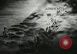
Allied forces clear German forces from control of the Scheldt River and open the Port of Antwerp in World War II
Map sketching positions of German forces at Alcheren and Arnhem separated by Allied forces at Antwerp and Numegen, Belgium, during World War 2. Views of the port at Antwerp silent and unusable due to German control of the Scheldt River downstream. British forces attacking those German forces at Walcheren, as Canadian, and Polish forces secure the South bank of the river. Royal Navy and Marines and Norwegians operating in the river itself. British minesweepers in the Scheldt River. View from the mine sweeper as mines are destroyed raising large plumes of water. The first supply ship arriving at port of Antwerp after Allied forces secured the river to the sea. The restored derricks and port facilities busy handling Allied ships and supplies. American Army trucks carrying supplies from the Port of Antwerp to Allied forces. Closeup of an African American soldier driving a truck. Supply trucks maneuvering around obstacles in a town. British soldier directing truck convoy traffic. Allied artillery barrage at night.
Preparation and planning of D-Day invasion of Normandy by Allied Forces during World War II.
Film titled ‘D-Day Convoy’ based on invasion of Normandy (D-Day) by Allied Forces during World War II. Soviet Leader Joseph Stalin, U.S. President Franklin Roosevelt, and Prime Minister of UK Winston Churchill seated at Tehran Conference in December 1943. Other officials stand behind the big three. U.S. General George Marshall, Supreme Commander of Allied Forces in Europe Dwight Eisenhower and other officials seated at a conference table. Map of France details cross channel assault of France by Allied Forces. Map shows coastal locations to be attacked by Allies. Weapons and equipment from America pouring into England. U.S. soldiers arrive in England and train, for the invasion, on southern coast of England. U.S. B-26 bombers hitting German targets and smoke billowing up from exploding bombs. B-17 bomber in flight and bombs falling on German industrial targets. Gunners on B-17s defend against German fighter aircraft. American bomber explodes in flight after attack by German fighter airplane. German Messerschmitt fighter is destroyed. From edited film produced in 1947.
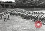
Moving of Allied troops and equipment to embarkation point in England for D-Day invasion of Normandy during World War II.
Recap of Allied Forces preparations for invasion of Normandy (D-Day) during World War II. Ground troops receive orders in England prior to D-Day. Trucks loaded with troops head for English Channel. Equipment move along a road. Troops receive gas masks, life belt, cigarettes, candy, and French money in a marshaling area. Invasion units being briefed on field by officers. Troops and equipment start to move toward embarkation point from marshaling area. Tanks, trucks, and heavy equipment move out from marshaling areas. Equipment being loaded aboard LST (Landing Ship Tank) and LCI (Landing Ship Tank) on southern ports of England. Amphibious vehicles, tanks, half tracks being driven into LST. Infantry march on street heading for harbor. Troops board ships in harbor. Soldiers board landing crafts used for shuttle service to travel back and forth from ships anchored. Troops leave landing craft and board ships anchored off shore. Invasion fleet in harbor. From edited film produced in 1947.
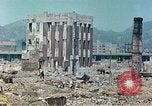
Damage inflicted upon Higashi Yanigawara-cho area in Kobe, Japan during World War II.
A survey of the damage inflicted upon Kobe, Japan during World War II. Damage inflicted on the area shows the effect of fire on a three-story brick load bearing structure in Tomiya-Cho of which the floors have collapsed. Interiors of a bombed out building. South and west faces of a two-story brick load bearing structure which was gutted by the fire. This building is located west of School Higashide-cho. A two-story brick load bearing structure which was gutted by the fire. This building was the Yamada Bank. Another building gutted by the fire is located on the main street in Toba-cho. Higashi Yanigawara-cho shows bank vaults among the rubble. Burnt out area of Higashi Yanigawara-cho. A private storehouse amongst the rubble. Rubbled area between elevated railroad and streetcar tracks.
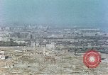
Areas near Higashi Yuenchi Park in Kobe, Japan which were affected by incendiary bomb attacks during World War II.
A survey of the damage inflicted upon Kobe, Japan during World War II. A view of Kobe Station Kawasaki and heavy industry and Higashi Kawasaki-cho. An area near Higashi Yuenchi Park shows effect of fire on a light steel frame structure and 2 and 3 story brick buildings. A two-story brick building was gutted by the fire and its south wall has collapsed. Gutted and partially collapsed buildings one block north of a harbor police building. A ruined brick building with rubble in the foreground. Rubble and damaged buildings near Hong Kong Shanghai Bank (Hongkong and Shanghai Banking Corporation).
CRITICALPAST.COM: About Us | Contact Us | FAQs - How to Order | License Agreement | My Account | My Lightboxes | Shopping Cart | Advanced Search | Featured Collections | Website Terms & Conditions | Privacy Policy ©2026 CriticalPast LLC.
License Agreement |
Terms & Conditions |
Privacy Policy
©2026 CriticalPast LLC.