


 Francais
 Deutsch
 Italiano
Refine Your Search
Puerto Princesa Island Philippines 1945 stock footage and images
- Showing 2323 to 2328 of 9920 results more
more Hide
Hide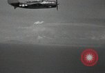
U.S. Navy SB2C Helldiver bombers fly over Bonin Islands, Japan during World War II.
U.S. air raid on Bonin Islands, Japan during World War II. U.S. Navy TBF Avenger torpedo bombers. U.S. submarine surfaces and advances. A Japanese ship burns in the background. Formation of U.S. Navy SB2C Helldiver bombers.
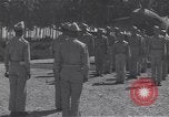
Award Ceremony on Guadalcanal, Solomon Islands. Major General Collins presents award. Several P-40 aircraft seen.
Decoration ceremony on Guadalcanal, Solomon Islands during World War II. Small unit stands in formation in front of a P-40 aircraft of the 44th Fighter Squadron on the Fighter 2 airstrip. U.S. officer reads citation. Commander of U.S. 25th Infantry Division, Major General Joseph Lawton Collins, shakes hand of 2Lt Jack Bade after awarding him an Air Medal. Several P-40s of 13th Air Force,seen nearby, with white stripes painted on them.
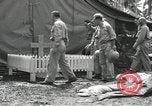
Chaplains approach the stone marker and look at the grave on the Solomon island in Melanesia.
A grave on the Solomon island, Melanesia. Chaplains arrive near the grave. A tent near the grave. The chaplains approach the stone marker. They look at the grave.
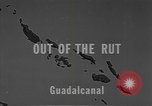
Men working to take out a B-17E which crashed while taking off and got stuck in a ditch in Guadalcanal, Solomon Islands.
A United States Army Air Forces B-17E Flying Fortress taken out from a ditch in Guadalcanal, Solomon Islands during World War II. The Flying Fortress named 'Galloping Gus' stuck in the ditch while taking off. Men working near the airplane to take it out. They try to lower the wheels of the airplane on a trailer bed. A bridge is made from steel mats. The airplane is towed out of the ditch.
Gunners are given a training with a stream of water and a model of a Japanese aircraft in Guadalcanal, Solomon Islands.
A gunnery training for U.S. gunners in Guadalcanal, Solomon Islands during World War II. A man in the model of a turret. Other men watching the training. The gunners are trained with a powerful stream of water. A revolving scale model of a Japanese aircraft. A gunner practicing.
Message and information received is quickly worked upon at the Naval Weather Service Command in Guam, Mariana Islands.
A documentary on the occurrence of tropical cyclones. Men working at the Naval Weather Service Command. Weather satellites detecting the earth's surface. An insignia on a wall. Exterior of the building of the Fleet Weather Central in Guam, Mariana Islands. A man working at a machine. Other man talking over a phone. A weather reconnaissance aircraft in flight overhead. A pilot in the cockpit. Observations which were made are collected and transmitted to a weather station. Men working on data and recording it. A warning message being typed. Positions are plotted immediately on a map as a message is received. Danger area is plotted on the map. A warning bulletin is updated as more information is received.
CRITICALPAST.COM: About Us | Contact Us | FAQs - How to Order | License Agreement | My Account | My Lightboxes | Shopping Cart | Advanced Search | Featured Collections | Website Terms & Conditions | Privacy Policy ©2026 CriticalPast LLC.
License Agreement |
Terms & Conditions |
Privacy Policy
©2026 CriticalPast LLC.