


 Francais
 Deutsch
 Italiano

Refine Your Search
Puerto Princesa Island Philippines 1945 stock footage and images
- Showing 289 to 294 of 9932 results more
 Hide
Color Sound

Japanese delegation meets with members of General MacArthur's staff to plan formal Japanese Surrender ending World War II
Japanese officials arrive to coordinate arrangements for a formal Japanese surrender, at a Conference in Manila, Philippine Islands. Headed by Lt. Gen. Torashiro Kawabe, Vice-Chief of the Army General Staff, the sixteen-member Japanese delegation descends steps from U.S. Army Air Forces C-54 transport Aircraft, tail number 44-9045, at Nichols Field, near Manila. General Kawabe salutes American Colonel Mashbir, coordinator of the Allied translator and interrogator Section. Major General Charles Willoughby, Director of Intelligence, leads them to waiting cars. Meeting in the City Hall in Manila, the Japanese officers surrender their personal swords and present documents delegating them powers Plenipotentiary by the Japanese Government. They file into a conference room, where they and American counterparts take their places across a long, black table. U.S. Army Lieutenant General Richard Kerens Sutherland, General MacArthur's Chief of Staff, presides over the discussions, accompanied by Major General S. J. Chamberlin, General MacArthur's Operations Officer. They are supported by Allied translators and interpreters. The conference is concluded successfully and sets the stage for the final formal surrender of Japan. (Note: Plans for this critical conference were developed by Colonel David Larr, Chief of Planning on General Chamberlin's staff.) The clip concludes with views of many U.S. warships and of cargoes being loaded in readiness for the occupation of Japan.
U.S. 8th and 5th Cavalry Regiment troops entering outskirts of Manila. Officers refer to map on the street
United States 8th Cavalry and 5th Cavalry Regiment troops enter Manila, Philippine Islands during World War II. 8th Cavalry Regiment troops file past dead Japanese lying in a street. Major General Verne D. Mudge, commander, U.S. 1st Cavalry Division, and Regimental officers study a map at a street intersection.
2nd Sino-Japanese war, precursor to World War II in the Pacific. Pearl Harbor attack. Early phase of Pacific conflict between Japan and the U.S.
The film 'Sea power in the Pacific' showing Japanese dominance in China and at start of World War 2. Then it chronicles U.S. efforts to build Navy and fight back on sea and in the air. Opening scene shows Japanese Mitsubishi G3M (Type 96) bombers high overhead, and then closeup in formation. View from bomber of bomb bays open with bombs falling and view from ground of explosions and destruction. Overlay on film says: "China---1931." (This is not correct. The G3M bomber was not yet in service.) This film depicts Japanese attacks during second Sino-Japanese War, commencing 1937, Chinese civilians running to escape Japanese bombing of Singapore. Buildings destroyed and on fire. Next, Japanese troops, carrying the Rising Sun flag, are seen establishing a beachhead in an Amphibious assault. More scenes of Japanese infantry advancing through Singapore, ad it is being destroyed and burned. Soldiers charging along an alleyway, with pagoda in background. Next, Japanese soldiers are seen attacking Nanking, and committing atrocities and killing Chinese during the so-called "Rape of Nanking," in December, 1937. Chinese civilians being summarily shot and dumped into a large open grave after execution. Two Chinese prisoners with hands bound, being executed by rifle fire. Jubilant Japanese troops celebrating their victory. Map shows areas of China occupied during second Sino-Japanese war and the East Indies to the South. View of oil tanks; an open pit tin mine; a native cutting rubber tree bark to collect latex. Flags on map show regions of English, French, and Dutch colonial interest. It also shows Islands to the East, fortified by the Japanese. Cartoon shows Japanese soldier opposed by and American sailor (representing U.S. Sea Power). Next, famous images of the Japanese attack on Pearl Harbor, Hawaii, December 7, 1941, are shown, including the USS Arizona burning and sinking. Hawaii, Midway, Wake, and the Philippines Islands, are highlighted on a map and Japanese control of the Pacific is illustrated. Japanese soldiers are seen displaying a captured American flag. U.S. Lieutenant General Jonathan M. Wainwright is seen surrendering the garrison at Corregidor, on May 6, 1942. View of Japanese General Masahara Homma discussing surrender terms with Wainright. Map shows interlocking web of Japanese fortified bases in Pacific and need for seapower to oppose it. View of American shipyard with hundreds of workers, employed to build ships for the war effort, in World War 2. Views welding, metal fabrication, and other shipbuilding activity. A new ship going down the ways and a woman christening a new ship with splash from bottle of champagne. A new "Liberty Ship," the Richard Bassett, going down the ways at Bethlehem-Fairfield Shipyard Inc. Baltimore, Maryland. Closeup view as the stern of another ship enters the water upon launching. View of it from a distance. Shipyard workers knock supports from under what may be a landing craft, as it is launched. Japanese warships underway in the Pacific and firing their naval guns. Explosions on a shoreline from naval bombardment. Japanese infantry wading ashore during an amphibious assault. Map shows where Japanese forces attempt an amphibious assault on Southern New Guinea, thwarted by the U.S. Navy in the battle of the Coral Sea of May, 1942. In June, 1942, a Japanese attempt against Midway Island, was again checked by the U.S. Navy in the Battle of Midway. View of USS Wasp (CV-7) carrier deck filled with airplanes, including Grumman F4F Wildcats. A Douglas SBD Dauntless dive bomber being cleared for takeoff from the Wasp. Gun camera film showing Japanese airplanes being shot down by pursuing U.S. aircraft.
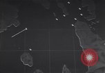
Animation outlines timeline of battle for the Surigao Strait starting with PT boat contacts with the enemy.
Animation shows Allied naval battle for the Surigao Strait in the Philippine islands during the Battle for Leyte Gulf. Segment begins with PT boats making radar contact and then physical contact with the Japanese naval-air forces during October 1944. (World War II period).
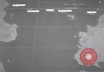
Animation show division 107 striking Japanese and then retreating in the Surigao Strait during the Battle for Leyte Gulf.
Animated map shows Allied naval battle for the Surigao Strait in the Philippine island during the Battle for Leyte Gulf against the Japanese naval-air forces during October 1944. Radar picks up enemy's presence. Division 107 strikes Japanese forces and then retreats quickly, making smoke. (World War II period).
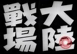
Various scenes of Japanese military activity in China, circa 1938 through 1942
Scenes of Japanese military activities in China, circa 1938 through 1942. Animated map shows thrusts of Japanese military forces at Guangzhou (Canton); Changsha to the North and points West circa 1938. A captured airfield with destroyed and damaged aircraft. A destroyed P-40 with Thunderbird image on its wing. A damaged P-40 parked in the grass displaying painted teeth motif of the Flying Tigers (American Volunteer Group of the Chinese Air Force). A scrap heap of airplane parts, at least one displaying the American star in circle insignia. A tattered map on Bulletin Board showing a logo on part of China. A village near the airfield. Japanese troops board a camouflaged barge to cross a river. A Japanese Ki-27 (Nate) airplane in flight overhead. Column of Japanese troops wending their way along a hillside. Smoke rising from explosions in a port town, with water and hill in background. Bombed out buildings in a town. Japanese infantry and an officer on horseback enter virtually deserted Chinese town. Camouflaged Japanese army vehicles and artillery travel on dusty road. A Ki-27 airplane flies low overhead. Japanese artillerymen set up 120mm gun and rangefinder. Battery of Japanese 120mm guns firing. Wreckage of an American B-25 aircraft. Wreckage of more Allied warplanes. Map showing Formosa; Wenzhou, opposite, on Chinese mainland; and Philippine Islands. Arrows depict Japanese military movements from the Ryukyu Islands. (World War II period).
CRITICALPAST.COM: About Us | Contact Us | FAQs - How to Order | License Agreement | My Account | My Lightboxes | Shopping Cart | Advanced Search | Featured Collections | Website Terms & Conditions | Privacy Policy ©2026 CriticalPast LLC.
License Agreement |
Terms & Conditions |
Privacy Policy
©2026 CriticalPast LLC.