


 Francais
 Deutsch
 Italiano
Refine Your Search
Tontouta New Caledonia 1943 stock footage and images
- Showing 4999 to 5004 of 10521 results more
more Hide
Hide
U.S. President Richard Nixon's silent majority speech from White House about Vietnam War.
A news special report about U.S. President Richard Nixon's speech from the White House about Vietnam War. A news correspondent reads news about the current status of war in Vietnam. President Nixon speaks from an office in the White House. President Nixon during his famous 'Silent Majority' speech. Richard Nixon details the history of Vietnam War and the ways North Vietnamese communists adopted to impose their government in South Vietnam. He says that immediate withdrawal of the United States forces would be a disaster for South Vietnam and the U.S. as well. He talks about steps taken to resume peace in the region and the progress of Paris Peace Talks.
U.S. President Nixon and his family in final departure from White House, escorted by Gerald Ford and others, Washington DC.
News report about farewell to the White House staff by outgoing President Richard M Nixon and appointment of new President Gerald Ford, Washington DC. President Nixon and his family depart from East Room of the White House towards its South Lawn, after Nixon delivers his final speech to the staff following his resignation. The staff, assistants and invited guests applaud for him. Dr Henry Kissinger and other advisors in the East Room. The South Lawn of the White House. President Nixon and Patricia Nixon escorted by Vice President Gerald Ford and his wife towards Presidential helicopter. The Nixon family boards the helicopter and Richard Nixon waves his hands and shows peace sign. Dignitaries including Mr and Mrs Gerald Ford, David and Julie Eisenhower stand and bid goodbye to President Nixon.The helicopter takes off and flies away from the South Lawn. News reporters talk about the event.

Resignation speech of U.S. President Richard Nixon from the Oval Office of White House, Washington DC.
News report and resignation speech of President Richard Nixon from the Oval Office of the White House, Washington DC. Demonstrators in Lafayette Park with majority of women raise banners and demand Richard Nixon's resignation. News anchor Jim Lehrer from the studio previews the speech. President Nixon from the Oval Office in White House delivers his resignation speech. President Nixon speaks about the Watergate Scandal and announces his decision to voluntarily resign from the post of President of United States and he announces that Vice President Gerald Ford will be sworn- in as the new President of the United States.

Re-enactment of British forces occupying the town of Monte Cassino, Italy, in World War II
Montage of scenes recorded after the Battle of Monte Cassino in World War 2. Opening scene shows New Zealand 19th RHQ tank in Mignano Montelungo, as the 24th New Zealand Battalion re-enacts its entry into the ruins of Monte Cassino, on March 26, 1944. In this restaging, 24th Battalion infantrymen are shown moving through rubble of destroyed town, firing small arms and one throwing a hand grenade. Narrator identifies "Hangman's Hill," (which was held by the 1st battalion 9th Gurkha Rifles) at Monte Cassino. In this restaging , New Zealanders, scramble over rubble, and dig out a "wounded" comrade, while explosions occur in background. Medics "attend" to him. Other NZ troops fire small arms from behind rubble barriers. A huge explosion occurs in background. A British artillery piece (obscured by debris) fires rounds. Infantrymen fire small arms. A camouflaged British tank fires its gun. In change of scene, other British troops advance cautiously near a damaged building and take several German soldiers prisoner. View of the destroyed Monte Cassino monastery and castle on Castle Heights. Ruins of building adjacent to the "Hotel Excelsior,"below the castle. Several medics with Red Cross flag in distant rubble. Views from destroyed Monastery atop the mountain. (World War II; WW II; World War 2; World War Two)

Influx of foreign immigrants add to total population in Northeastern States of the United States.
Animated map of Northeastern United States bounded with Middle States and Southeastern States. Map depicts geographical condition of Northeastern States. Map marks States of Maine, New Hampshire, Vermont, Massachusetts, Rhode Island, Connecticut, New York, New Jersey, and Pennsylvania. Map shows Northeastern settlement during colonial period by Scotch, English, Dutch, Germans, and Swedes. Also shows influx of French Canadians during early 19th century and immigrants from different countries occupying urban Northeastern centers. Map explains the population occupying region.
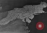
Port cities connected by railroads with industrial regions of Northeastern States of the United States.
Northeastern States of the United States serve as an industrial regions. Animated map shows port cities of New York, Boston, Baltimore, Philadelphia, and Portland used for transoceanic and coastal trade. Map depicts port cities connected by railroads with industrial regions of Northeastern States of the United States. A moving railroad train running parallel to the Hudson River in New York. View of New York Municipal Airport terminal (also known as LaGuardia Field, or LaGuardia Airport), as passenger aircraft taxi in foreground. Map depicts the daily flights from Northeastern States.
CRITICALPAST.COM: About Us | Contact Us | FAQs - How to Order | License Agreement | My Account | My Lightboxes | Shopping Cart | Advanced Search | Featured Collections | Website Terms & Conditions | Privacy Policy ©2026 CriticalPast LLC.
License Agreement |
Terms & Conditions |
Privacy Policy
©2026 CriticalPast LLC.