


 Francais
 Deutsch
 Italiano
Refine Your Search
US-Gliders- stock footage and images
- Showing 1297 to 1302 of 21920 results more
more Hide
Hide
United States Army Air Force make use of Norden bombsight to bomb German targets in Germany during World War II.
Use of Norden bombsight by United States Army Air Forces during World War II. Shows Norden bomb sight being unloaded from an aircraft. U.S. planes in flight. A bombardier at a bombsight aboard a U.S. bomber plane. U.S. pilots being briefed in England. Bombs are loaded on planes. United States Army Air Force B-24J Liberator bomber planes in flight. The bombardier at a bombsight aboard a USAAF B-17G Flying Fortress bomber plane. B-24Js under attack by German Messerschmitt planes. Bombs are released from a plane. The bombs explode over targets on the ground.
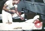
A dengue mosquito control campaign by the U.S. Army on an island in the South Pacific during World War II.
U.S. Army personnel catch dengue fever on a South Pacific island during World War II. Men on beds are given tablets. A sign for dengue fever. A U.S. Army camp near a native village on an island shows breeding places for Aedes mosquito which transmit dengue to humans. Mosquito control specialists destroy all the breeding places. Men inspect fuel drums and cans. A sign reads 'cans must be burnt'. Cans are smashed and bottles are broken. The cans are dumped in large containers. Gambusia fish are put into water to feed on dengue mosquito larvae. Swamps are drained. Coconut shells are burnt. Men spray drums of water. An official report after carrying out the cleaning campaign. U.S. troops after recovering from dengue fever. Locations on a world map show the spread of dengue fever. U.S. soldiers are treated for dengue.
U.S. troops land on an enemy island under bombardment during Pacific campaign of World War II, Pacific Ocean Theater.
Film titled ‘Remember These Faces’ shows U.S. troops land on an enemy island during a Pacific campaign of World War II. U.S. warship fires guns towards an enemy island in the Pacific Ocean. Landing craft underway as they head for beach. Supplies, troops, and equipment being readied to be transported on beach. Troops disembark from ship onto LCMs (Landing Craft, Mechanized). LCMs head for the beach. Warship’s gun fire at shoreline. Enemy bombers in flight overhead as they attack the U.S. troops heading for the beach. Amphibious vehicles of U.S. army hit the beaches. Troops advance inland under bombardment. Dead bodies of soldiers on beach. Troops with rifles advance inland.
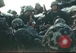
Wounded U.S. soldiers being treated during Pacific campaign of World War II, Pacific Ocean Theater.
U.S. soldiers land on an enemy island and being wounded in action during a Pacific campaign of World War II. U.S. troops care for wounded soldiers being hit during initial enemy attacks. Another wounded soldier being carried on a stretcher inland. Wounded soldier being placed on a jeep. Shell blasts on the island. Jeep pulls away. U.S. tanks advance on island. Wounded soldiers of U.S. army being brought at a field hospital. First aid and plasma being given to wounded soldier by medics. Leg of a wounded soldier affected by gangrene being treated. Wounded soldiers being loaded into ambulances and evacuated. Enemy shells fire on island as smoke rises from explosions.
Methods of communication used by United States Marine Corps in jungle warfare in Pacific Theater during World War II.
Reconstruction about deployment of U.S. Marine Corps on island of Pacific and precautions taken by them during jungle warfare in World War II. Marines camouflaged with foliage use camouflage make-up and hide under bushes waiting for Japanese troops. Japanese officers being attacked by Marines hiding under bushes. Marines come across a wire in jungle leading to ambush. They repair the broken wire temporarily. Jungle communications method as a Marine changing position of his canteen from right to left and carrying the message in upper left pocket which identifies him as runner or messenger. Two U.S. Marines search a wounded Marine lying in jungle and identify him as a messenger. Another method of communication depicts Marine using semaphore signal from a hilltop. Group of Marines receive the semaphore signal.
Problem of getting U.S. supplies to China during Japanese aggression in China during World War II.
A film titled 'Coming Kunming' based on the problem of getting supplies to China and the activities of U.S. Troop Carrier Command during World War II. Japanese troops march into a Chinese town during Sino-Japanese war. They advance during an invasion. A map highlights the Burma Road linking Burma with China and Kunming, Yunnan and Lashio as its terminals. A Chinese woman works on the road. Trucks move along the road. The Ledo Road as an alternative to the Burma Road which had been cut by the Japanese Army. U.S. Army Air Force B-24 Liberator bombers in flight over the Himalayan Mountains. Inadequate dock facilities in Calcutta, India. A map details transportation problem. Native labor is used for the construction of a U.S. air base in India. Building of rail road lines. Chinese laborers work in China. Cargo ships underway at sea.
CRITICALPAST.COM: About Us | Contact Us | FAQs - How to Order | License Agreement | My Account | My Lightboxes | Shopping Cart | Advanced Search | Featured Collections | Website Terms & Conditions | Privacy Policy ©2026 CriticalPast LLC.
License Agreement |
Terms & Conditions |
Privacy Policy
©2026 CriticalPast LLC.