


 Francais
 Deutsch
 Italiano
Refine Your Search
Japanese-martial-arts stock footage and images
- Showing 4069 to 4074 of 4336 results more
more Hide
Hide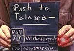
U.S. Marine Corps 1st Marine Division soldiers give first aid to wounded in Talasea,New Britain during World War II.
Marines of U.S. 5th Regiment, 1st Marine Division, advance toward Talasea, New Britain in World War 2. Marines load and fire 75mm Howitzer. A tank stuck on a dirt road. The Marines dig around the tank's tread. The Marines give first aid to a wounded man. Two Marines seated with bandaged faces and legs. Dead Japanese soldiers on the ground. A shrine in the jungle.
United States Marine Corps of the 6th Marine Division fire rifles in Okinawa, Japan during World War II.
6th Marine Division of the United States Marine Corps at Naha, Okinawa in Japan during World War II. A United States M4A3 Sherman tank moves along a road. A Marine walks beside the tank. Marines fire from behind a stone wall. M4A3 Sherman tank fires at the enemy. Damaged Okinawan houses in the village. The Marines advance on hilly terrain and fields. One of the Marines throws satchel charge outside a Japanese cave entrance. Smoke and explosion at the cave. 6th Marine Division Corps fire rifles.
Marines of the 6th Marine Division shoot at enemy in caves in Okinawa, Japan during World War 2.
6th Marine Division of the United States Marine Corps in Okinawa, Japan during World War II. Fire and explosion at Japanese cave entrance. An M4A3 Sherman tank moves along a road. A Marine walks beside the tank. Marines fire rifles.
United States Marine Corps of the 6th Marine Division enter the city of Naha in Okinawa,Japan during World War II.
6th Marine Division of the United States Marine Corps in Naha, Okinawa, Japan during World War II. Marines enter the city and patrol on streets. A damaged bridge in the background. An M4A3 Sherman tank with Marines along the road. Tanks fire at Japanese trenches. The wounded Marines on stretchers being put on an ambulance jeep.
United States Marine Corps advance with Sherman tanks in Guam, Mariana Islands (WW2)
United States Marine Corps in Guam, Mariana Islands during World War II. Marines move past burning tanks in the jungle. A charred hand of a dead soldier stick out of burned tank. Marines with M4A3 Sherman tanks advance on a road. The tanks fire at Japanese enemy positions. Fire and explosion in the bushes. An officer smokes a cigarette. The Marines advance uphill on Mount Santa Rosa. Some Marines help their comrades climb up the hill.
U.S. Army 710th Tank Battalion supporting U.S. Marines in Battle of Peleliu, during World War II in Pacific
M4 Sherman tanks of the U.S. Army 1st. Platoon, A Company, 710th Tank Battalion provide fire support to Marines of 3rd Battalion, 5th Regiment, at Horseshoe Valley in Peleliu Island, Palau during World War 2. View from Marine position overlooking the valley, as M4 tanks slowly move through the valley battleground. The tanks are accompanied by Marine infantry. Explosions and smoke rise from hillsides as shells fired by tanks (unseen) explode. View from behind Marines watching the explosions. Glimpse of an M4 Sherman tank with name, "Honey Rose" on its side. Camera pans over smoke rising from shelling. Brief closer view of tanks moving slowly in the valley and firing their guns. Infantry moving beside and behind a tank. Three tanks together firing their guns. More explosions and smoke in the hillsides. Closer view of tanks. Another view of the three tanks firing together. (Note: Reportedly, the tank named "Honey Rose" was driven by Sergeant James A. "Jack" dayton, Jr. of Wheeling, West Virginia, who named the tank after his wife, "Rose." It was later struck by a Japanese anti-tank round that killed their machine gunner.The rest of the crew left the crippled tank with minor injuries.)
CRITICALPAST.COM: About Us | Contact Us | FAQs - How to Order | License Agreement | My Account | My Lightboxes | Shopping Cart | Advanced Search | Featured Collections | Website Terms & Conditions | Privacy Policy ©2026 CriticalPast LLC.
License Agreement |
Terms & Conditions |
Privacy Policy
©2026 CriticalPast LLC.