


 Francais
 Deutsch
 Italiano
Refine Your Search
Japanese-martial-arts stock footage and images
- Showing 4075 to 4080 of 4336 results more
more Hide
Hide
United States 4th Tank Battalion advances in Tinian,Mariana Islands during World War II.
United States Marine Corps of the 4th Tank Battalion in Tinian, Mariana Islands during World War II. The tanks fire at Japanese positions. Green fields with sugarcane plantation. The Marines patrol on fields. The tanks advance along forest area.
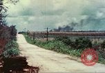
United States 4th Tank Battalion drives on road in Tinian,Mariana Islands during World War II.
United States Marine Corps of the 4th Tank Battalion in Tinian, Mariana Islands during World War II. A U.S. tank and jeep drives past sugarcane plantation on road. Smoke rises from an explosion in the background. Dead Japanese soldiers on the ground.
United States Marines Corps dig on front line in Iwo Jima Island during Iwo Jima operation of World War II.
United States Marine Corps in Iwo Jima Island during Iwo Jima operation of World War II. The Marines dig on front line in hilly terrain. An explosion and smoke rises in the background. The Marines run across the terrain. Japanese radar atop a hill. Explosions on hillside. The Marines bring ammunition at a dug out. A United States tank burns near the airstrip.
Troops of United States 1st Battalion,151st Infantry Regiment of 38th Division at Carabao Island,Philippines.
United States 1st Battalion, 151st Infantry Regiment of 38th Division at Carabao Island, Philippines. The Battalion advance uphill towards Japanese enemy. The soldiers cross a ravine. Smoke rises from an explosion on hillside. The crew members prepare to attack on enemy positions. (World War II period).
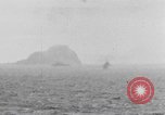
U.S. warships bombard Corregidor during Philippines campaign in World War II
U.S. warships bombarding corregidor during World War 2. Heavy smoke rising from shelling. Camera pans across the water showing variety of U.S. warships.Japanese mines being exploded, in the water, by machine gun fire from U.S. ship.
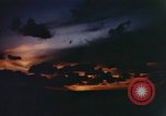
United States Marines in combat on Pacific Island and combat cameramen filming Marines in action in Pacific Theater
United States Marine Corp photographers take pictures with 35mm movie camera in the Pacific Theater during World War II. View of sunset. Huge explosions at night during night battle against Japanese enemy. Next scene is day time with Marines in many foxholes and bomb craters in exposed battlefield area on Pacific Island during combat. Two Marines hunched over and moving between positiions. Marines receiving enemy fire. Several scenes showing combat photographers (some dramatized) taking up positions in ditches and fox holes to record combat action with still cameras and motion picture cameras. Actual battle scenes of Marines pinned down by incoming enemy fire on an Island. Marines coming ashore on landing craft at beach area and marching in a group up a road. Marine combat cameramen in a ditch capturing action with motion picture movie camera. Titles of films are seen next on screen, reading 'With marines at Tarawa', 'Memphis Belle', 'Fighting Lady' and 'The True Glory'. Marine photographers check and clean parts of motion picture camera. Marine types on a portable typewriter beside him.
CRITICALPAST.COM: About Us | Contact Us | FAQs - How to Order | License Agreement | My Account | My Lightboxes | Shopping Cart | Advanced Search | Featured Collections | Website Terms & Conditions | Privacy Policy ©2026 CriticalPast LLC.
License Agreement |
Terms & Conditions |
Privacy Policy
©2026 CriticalPast LLC.