


 Francais
 Deutsch
 Italiano
Refine Your Search
Kiska Aleutian Islands Alaska 1944 stock footage and images
- Showing 145 to 150 of 9823 results more
more Hide
Hide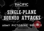
U.S. 13th Air Force B-24 bombers attack Shell oil refineries and storage facilities at Lutong,Miri, Borneo, in Wor
Map shows location of Labuan Island , Borneo. Views from a U.S. 13th Air Force B-24 Liberator bomber as it conducts a low-level bombing and strafing attack against oil refinery and storage tanks at Labuan Island, on December 8, 1944. View from the B-24 as it flies low over the target, and its waist gunners fire 50 caliber machine guns, using indendiary rounds, at storage tank farm. Scenes from a second B-24 in a similar raid on December 10, 1944. Views of the storage tanks ablaze and billowing smoke. (World War II period).

American General William D Mitchell speaks on importance of air power and demands the construction of airbase in Alaska.
American General William D Mitchell (aka Billy Mitchell) at a desk in his office in Middleburg, Virginia. General Mitchell points out the loopholes in air support at Long Island for New York. He urges that America must build up its strength in building more bomber aircraft. General Mitchell says that air power is the prime strength of any nation for directly attacking the enemy's key installations. The General demands the construction of an air base in Alaska.

Destruction in coastal northeast USA from the 1944 "Great Atlantic Hurricane" (First example of a named hurricane in the US)
Views of The Great Atlantic Hurricane lashing at northeast United States areas (after having already hit the North Carolina Outer Banks), and views of the aftermath and early cleanup following the storm. Regions shown include Atlantic City, Long Island (where it came ashore as a category 3 hurricane on September 15, 1944), New York City suburbs, and parts of New England. High surf flooding boardwalks and coastal cities. Trees bent over and snapped in high winds. People walking with difficulty in the high winds. Streets of towns submerged in water. Coastal docks destroyed and large boats scattered high onto shore areas. Trees, poles, and wires downed over roads and homes. Entire homes moved off of their foundations and placed down the street. The "Great Atlantic Hurricane" was the first example of a named hurricane by the Miami Hurricane Warning Office, which later became the National Hurricane Center. The name was meant to reflect the hurricane's size and intensity.
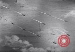
Naval battle between Allied and Japanese destroyers during the Battle off Samar near the island of Leyte in the Philippines.
Shows the Battle off Samar which was the central action of the Battle of Leyte Gulf. It took place in the Philippine Sea off Samar Island near the island of Leyte in the Philippines on October 25 1944 Animated map shows Allied naval fleet under heavy fire from the advancing Japanese fleet. Naval battle between enemy destroyers and allied destroyers such as USS Johnston, Hoel and Roberts. (World War II period).
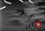
Battle between Allied and Japanese naval-air forces during the Battle off Samar near the island of Leyte in the Philippines.
Shows the Battle off Samar which was the central action of the Battle of Leyte Gulf. It took place in the Philippine Sea off Samar Island near the island of Leyte in the Philippines on 25 October 1944. Animated map shows battle between Allied naval-air forces and Japanese naval-air forces. Japanese kamikaze suicidal dive bomber strike on Allied fleet and inflict heavy damage to a few Allied ships. (World War II period).

Battle off Samar near the island of Leyte in the Philippines, during World War 2.
Shows the Battle off Samar which was the central action of the Battle of Leyte Gulf. It took place in the Philippine Sea off Samar Island near the island of Leyte in the Philippines on October 25th 1944. U.S. air forces launch a counterattack on the enemy's ground forces. Animated map shows heavy battle between Allied naval-air forces and Japanese naval-air forces. Allied AA guns fire at Japanese kamikaze suicide dive bombers. One of the dive bombers strikes USS St Lo (CVE-63). View of U.S. Navy aircraft on carrier deck in flames. Narrator indicates the St. Lo was sunk. Views from some miles away of smoke pouring from U.S. aircraft carrier. The results of the battle shows heavy damage inflicted to the Allied naval fleet.
CRITICALPAST.COM: About Us | Contact Us | FAQs - How to Order | License Agreement | My Account | My Lightboxes | Shopping Cart | Advanced Search | Featured Collections | Website Terms & Conditions | Privacy Policy ©2026 CriticalPast LLC.
License Agreement |
Terms & Conditions |
Privacy Policy
©2026 CriticalPast LLC.