


 Francais
 Deutsch
 Italiano
Refine Your Search
Russia 1953 stock footage and images
- Showing 727 to 732 of 1877 results more
more Hide
Hide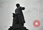
Japanese forces engaged against Chinese forces in the January 28 Incident (Shanghai Incident) of 1932
Film opens showing a Japanese monument commemorating officers in the Russo-Japanese War between Russia and Japan. Commander of a small contingent of Japanese troops offers saki to his soldiers, before they march off into combat. They rush into trenches and begin firing at Chinese forces. Next, Japanese infantry are seen moving across vast barren lands, as some take up defensive positions behind those advancing, who also begin digging holes and setting up defenses after their advance. Chinese artillery shells explode close ahead of them. Soldiers in the Japanese front lines throw smoke canisters and dense white smoke is carried by the wind to the left and side of their positions. As the smoke dissipates, shells burst again, right in front of the Japanese lines. Immediately, after, the Japanese troops leave their defensive positions and charge forward. View of a small battlefield cemetery with posts marking the graves of Japanese soldiers.
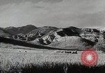
Contrast between Chinese and Japanese national aspirations before Second Sino-Japanese War and WW2
Film reviews China's four thousand years of history. Scenes showing mountains, woods, and a farmer plowing with oxen in rural China. A mass of Chinese people tightly packed together as they walk along a narrow alleyway in a town. Fleeting glimpses of two Chinese soldiers; a child; a woman; a woman and child; and numerous other Chinese people in a montage splayed across a background of moving crowds. An open book of Chinese characters. Mariners compass superimposed on an moving image of an ocean liner. Views of several large-scale astrolabes and world globes. A Chinese worker placing porcelainware in an oven for glazing. A man spooning gunpowder into a dish, followed by glimpse of a Chinese firework igniting. Chinese paper Dragon and street celebrations. A book entitled: "Analects of Confucius," in which, on page 105, is found the admonition: "What you do not want done to yourself, do not do to others." Ancient statues of two men and of two riderless horses behind them. Tall Chinese pagodas. Chinese artillery field pieces firing. Chinese troops advancing in several situations during conflict with Japan. Map of China and illustration of Japanese samurai warrior emblazoned across it. A book entitled: "The Tanaka Memorial, (Japan's Dream of World Empire)." A still photograph of Japanese Foreign Minister Baron Tanaka Giichi in military uniform, with other Japanese officers. Excerpts shown, ostensibly from this book. Emperor Hirohito is seen with Baron Tanaka, and other officers, all in military uniforms, in front of a tent, circa 1928. Automated map ostensibly illustrates the elements of a Japanese plan of conquest, starting with Manchuria for raw materials; the absorption of China for manpower; followed by a sweep South for riches of the Indies and Australia; and lastly a sweep eastward to crush the United States. More views of crowds of Chinese people are followed by an. animated map illustrating early World War II events, including Nazi Operation Barbarossa against Russia, approved by German leader Adolf Hitler in 1940, and the Nazi German occupation of Denmark, Norway, and other European countries. (Note: Actual existence of the so-called "Tanaka Memorial Imperialist Conquest Plan" is a subject of debate among historians.)
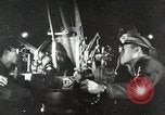
Japanese actions leading to 2nd Sino-Japanese war and attack on United States at Pearl Harbor in World War II
Japanese army officers examining foreign military equipment. A Japanese worker employing electric drill developed in a Western country. The Japanese freighter, Tatsuno Maru, loading scrap iron at a port in the United States. Other Japanese freighters loading coal and oil for shipment back to Japan. View of the Washington Naval Conference in Memorial Continental Hall, Washington, DC, held in 1921-22 and again in 1927 and 1930, to deal with several lingering issues. Glimpse of Japanese people holding flags while gathered near the Imperial Palace in Tokyo. Glimpse of Japanese army troops on parade. Japanese Navy warships at sea. A fleet of Japanese Mitsubishi G3M bombers and Nakajima Ki-27 pursuit planes, parked on an airfield. A loose formation of Ki-27s airborne. Animated map illustrates Japanese fortification of Mariana, Caroline, and Marshall islands in the Pacific. Animated map illustrating China's greater size and population vis-a-vis Japan. Animated map illustrating Japanese occupation of Manchuria in 1931. New York Times newspaper with headline "Japs Seize Manchuria" hovers over fires burning in Manchuria. Other newspaper headlines reporting on Mussolini's invasion of Ethiopia; the Spanish civil war; surrender of Czechoslovakia; invasion of Poland; assaults on France, Belgium, and the Netherlands by Nazi Germany; the London Blitz; and Nazi advances against Russia on the Eastern Front. Fnally, a Boston Hearald extra edition headline reports: "Pearl Harbor Bombed." A still photograph of Japanese Baron Tanaka Giichi (on left) with two other dignitaries, circa 1929. Japanese infantry streaming into Manchuria and then celebrating as they walk into local town. A busy street in a Chinese city. Japanese soldiers in Manchuria escorting local prisoners along a street. Animated map illustrating Japananese warships surrounding harbor of Shanghai, China. View from a Japanese ship bombarding Shanghai. Smoke rising from shell striking on Shanghai waterfront. View from land of severely damaged buildings on a street, and a shell exploding in background, as Chinese defenders move to successfully repel the Japanese forces. New map illustrates subsequent Japanese move, annexing Jehol, from occupied Manchukuo, and Korea. Japanese troops entering a town in Jehol. Sun newspaper headline: "League Censures Japan." Chinese diplomat protesting at League of Nations. Japanese troops exiting railroad trains in Jehol. Aisin Gioro Puyi aka Henry Pu Yi, Kangde Emperor (Kang-te Emperor) of the Japanese puppet state of Manchukuo, is seen saluting Japanese troops on parade. Closeup of Puyi wearing shaded glasses, looking directly into the camera. chiang Kai-shek, with other Chinese officers. Reenactment of barbarian forces riding against China and thwarted by the Great Wall. Many Chinese walking in a long line along the Great Wall. Map tracing the Great Wall across China. Aerial view of the Great Wall from overflying airplane. Japanese troops marching through a city gate; infantry climbing a sheer cliff; and helmeted Japanese soldiers marching past civilians in a city. Map illustrated progress of Chinese unification by year 1937. Japanese officers conferring during occupation. Japanese troops leave a barracks, riding in open trucks. A line of the troop trucks moving along the dirt street of a town. The troops climb from their trucks in the town.
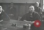
China builds Burma Road to carry war materiel and supplies and creates flood of Yellow River to thwart Westward expansion of Japanese occupied territory
Japanese officials meeting in strategy session. Japanese infantry on mission to cut Chinese supply lines during 2nd Sino-Japanese war. Black smoke rises as they move along a river bank. Chinese prisoner-workers are forced to rebuild railroads destroyed by the Chinese people during their great Westward trek. Japanese soldier closely guards workers. A Japanese army armored train underway on the rebuilt railroad, as Japanese soldiers cheer. Animated map shows China's supply lines by sea, to Tsingtao, Hangchow, and Amoy, cut off by Japanese naval blockade. Japanese Navy launch with officers and crew moving near commercial ships as they take over Chinese river ports. War materiel and other supplies destined for China, including trucks, sit idle, unable to be transported to their destinations. Large oil tanks and drums of gasoline are shown, as well as gun barrels and a flightline filled with parked Curtiss P-36 Hawk aircraft. The Imperial Japanese Navy destroyer Asakaze (DD-3) and another, next to it, in a Chinese river port. A Japanese freighter with anchored weighed, secured by long lines to a wharf. Small boats flying Japanese Naval ensigns are next to it. View of map showing china, Burma, Indo-China, and Chungking, with Japanese blockading fleet stationed in the South China Sea. It traces path of narrow gauge rail line from Indo-china to Kumming,China, where it connected to an overland road to Chungking. Next it traced the old Camel Caravan route, across China, from Russia. Narrator notes these were to small to be useful and too close to Japanese-occupied territory. Next, the map traces a railroad that from the port of Rangoon to Lashio, Burma. It is separated from the road to Chungking, by mountains and gorges. Views of the actual mountainous terrain. Animal pack trains moving through the area. Construction engineers in a large drafting room designing a road to transit the area. View of modern road-building caterpillar tractor equipment of the type needed to accomplish this. View of Chinese laborers using manpower instead. They push large rollers and employ pickaxes and other hand-held tools to carve away and dig road beds. Masses of Chinese laborers at work, carving a road along the edge of a mountain. Two-men teams using manual tampers to pound down the roadbed. Children are employed along with adults. A woman with a baby on her back, pounding large rocks into gravel, surrounded by other children doing the same. View from above of the "Burma Road," the product of their labors, winding its way through the mountains and gorges. Many scenes of trucks moving along portions of the Burma Road. P-40 airplanes flying past white cumulus clouds, overhead. Animated map shows continued expansion of Japanese occupied areas to encompass two thirds of the rail lines in China with goal of controlling the remainder, starting at Chengchow, in Summer, 1938. View of Chengchow region, on banks of the Yellow River. Map illustrates flow pattern of the Yellow River. View from past of the Yellow River's Spring floods toward the Sea, with Chinese people throwing rocks onto dikes that keep the river flowing in a more Northerly direction than its former course. Illustration shows how with Japanese encrouching on Chengchow, the Chinese decided to destroy those dikes and allow the river to flood over its former more Southerly course. Japanese soldiers being inundated by the flooding river. Japanese infantry and tanks regrouping on their occupied side of the new (old) path of the Yellow River. Local Chinese residents of Chengchow, wade with belongings as they leave their flooded homes.
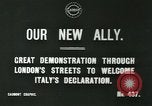
British people on streets of London celebrating Italy's decision to enter World War 1 on the side of the Triple Entente
Celebrations on London's streets following Italy's decision to join the Triple Entente– Britain, France and Russia -- and declare war on Austria-Hungary, during World War I. Crowd on street gathers for demonstration, vehicles also on road. Crowd stand in front of building with flags. Kingdom of Italy flag flies.
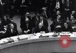
U.S. Ambassador Adlai Stevenson informs UN about steps taken in meeting of Organization of Consultation in United States.
Ambassador Adlai Stevenson addresses United Nations Assembly about United Sates action against Cuba and Russia, during timeframe of Cuban Missile Crisis. Ambassador Stevenson hopes and prays for peace. He tells Soviet Union to end their actions against United States. He refers to the initiative of President John F Kennedy to quarantine war. He informs about the Organization of Consultation meeting, which is a part of the Organization of American States. He then talks about the resolutions in 19 paragraphs adopted by them. First is immediate dismantling of offensive metals from Cuba. Second, he refers to article 6 and 8 and all necessary measure including use of arms against any offensive attempt on U.S. Third, is to inform security council of UN under article 54 of U.S. charter about the resolution, and the same information to be given to Cuba.